Today’s blog was co-written by Zander Evans and Rachel McCullough, Executive Director and 2024 intern at the Forest Stewards Guild.
Hello Fireshed friends,
What do old trees and forests have to do with wildfire? In turns out, there is an important connection! Old growth forests play essential roles in our forests related to wildlife habitat, species diversity, hydrological regimes, nutrient cycles, carbon storage, and numerous other ecological processes. They support rich biodiversity due to the unique structures and habitat features that they develop over long periods of time. Areas of old forest in ecosystems adapted to frequent fire often have patches of large trees interspersed with grassy openings and canopy gaps. However, these forests can be negatively impacted by uncharacteristic (hot, fast-moving, high severity) fire and other impacts of a changing climate. New efforts to conserve and protect old growth have brought these important parts of the forest to center stage.
Today’s Wildfire Wednesday features:
Be well,
-Rachel
The Story of Fire and Old Trees
What is old growth?

Old growth forests can generally be defined as those dominated by large, old trees, both live and dead, standing and fallen, that usually contain many other smaller trees. Old growth forests can occur anywhere, though usually they are found in areas protected from disturbance. These old forests are rare, and unfortunately becoming rarer every day due to natural disturbances like fire, human disturbance where old growth isn’t protected, and the warming and drying climate.
Because old trees and old-growth forests are rare, they add diversity to forest ecosystems with their uncommon characteristics. Old-growth forests have structures such as large trees, large downed logs, and standing dead trees that are not present in young or maturing forests. The unique structures and attributes of old growth forests provide habitat for plant and animal species not found in other forest types. They also play important roles in hydrological regimes, nutrient cycles, and numerous other ecological processes. In addition to the biodiversity, wildlife habitat, hydrologic function, and carbon storage it supports, old growth is valued for recreation, aesthetics, inspiration, or even spiritual reasons.
Old growth and fire in New Mexico

In Redwood National Park, large live trees are interspersed with decadent dead and down snags and logs.
When you picture ‘old growth’, the image that comes to mind is likely decadent redwood or giant sequoia forests in the Pacific Northwest. Did you know that we also have old trees and old growth forest here in the Southwest? Old tree stands have characteristics such as variable tree size and spacing, accumulation of dead standing and fallen trees, decay, multiple canopy layers, gaps, and dominant large trees. These old trees are far less abundant today than they were in the mid-1800s, before the arrival of the railroad brought clearcut logging and a thriving timber industry. Luckily, New Mexico’s boom-and-bust timber industry had a limited reach due to the challenging terrain, roadless landscape, and associated financial costs, and old growth trees still persist in mid-elevation forested areas across the state.

A 7’ scar, partially healed over, on a large mature ponderosa pine tree in the Pecos Wilderness.
Ponderosa pine trees, a dominant fire-adapted species in New Mexico, begin to develop old growth characteristics between 200 and 300 years of age. They can be identified by their thick bark and fire scars (a place where fire has burned through the bark and damaged a portion of the trunk but the tree has survived and healed over the wound). Characteristics of old ponderosa pines include orange-yellow to occasionally grey bark with large, smooth plates; raised, relatively open, flattened crowns (there is a lot of distance between the ground and the first branch, the branches are not too crowded along the trunk, and the top of the tree is rounded rather than pointed); large-diameter branches; and evidence of past disturbances such as fire scars, lightning-strike scars, or a damaged top. Frequent-fire forests with old trees often have a high canopy and uncrowded understory due to frequent low intensity fire keeping the stands open and preventing shade tolerant competitors from establishing. Keep an eye out on your next stroll through the woods for large-diameter thick-barked trees, especially in drainages and remote areas!
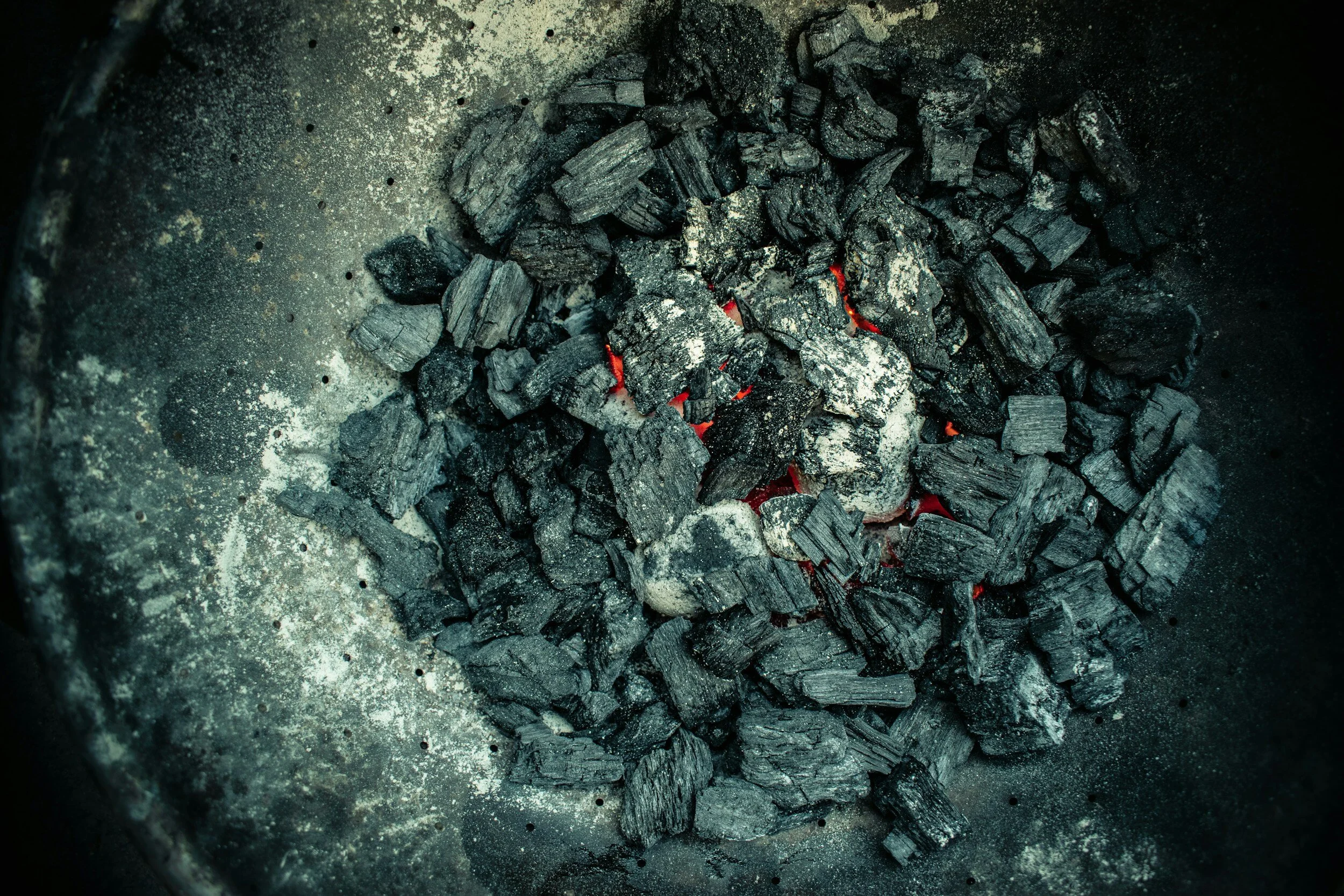
While trees like ponderosa pine and Douglas-fir are resistant to low severity fire when they are old, they can be killed by high intensity wildfires that climb into the forest crown and burn very hot. Ecologically-based stewardship is focused on reducing the risk of high intensity wildfire through thinning and controlled burns – in part to protect these rare, old trees. During controlled burns, old trees are protected by raking litter and duff away from their trunks. This reduces the amount of combustible material around these old trees and helps ensure the low intensity burns don’t smolder and kill their roots or cambium. Restoration work which thins the forest to historic levels can help maturing trees grow larger and become the old trees of the future. Thinning reduces the competition for water and nutrients between trees and helps remaining trees survive drought, grow larger more quickly, and become more resilient to pests, disease, and a hotter and drier climate.
New Federal Policies to Conserve Old Forests
An amendment to the National Forest Plan
On April 22, 2022, the Biden Administration issued Executive Order 14072, which directs the United States Department of Agriculture and the United States Department of the Interior to define, inventory, identify threats towards, and develop policies to mitigate threats to, mature and old growth forests.

An old growth alligator juniper in the Gila National Forest showing a rare hollowed fire scar at the base of its split trunk.
In response, the US Forest Service has proposed a National Forest Plan Amendment that would make long-term resilience the primary objective for forests with old growth characteristics. In addition to ensuring old growth forests persist into the future, the Plan Amendment will foster mature and maturing forests to become the old growth of the future.
As part of the federal effort to protect old forests, researchers conducted a nation-wide inventory and found 32 million acres of old growth forests. Of that total, 1.3 million acres is comprised of ponderosa pine and 9 million acres is made up of piñon-juniper forests, two dominant forest types in the Southwest. Researchers used that same federal Forest Inventory and Analysis to determine that since the year 2000, we have lost 712,000 acres of old growth to wildfire, 182,000 acres to insects and disease, and 9,000 acres to tree cutting on lands managed by the Forest Service and Bureau of Land Management. Even more worrisome is the prediction that by the end of the century, 90 percent of old-growth forests will be at very high exposure to wildfire-caused mortality and nearly 60 percent will be exposed to drought.
Ahead of the curve, close to home

While the proposed National Forest Plan Amendment would increase the conservation of old trees nationally, it is unlikely to change management in many forest restoration areas across New Mexico - such as the Santa Fe Fireshed and the Zuni Mountains Landscape - because protection of old and large trees has been a priority in these areas for many years. In 2006, a wide range of groups including federal and state interests and nongovernmental organizations came together to codify their agreement in the New Mexico Forest Restoration Principles. These Principles emphasized the restoration of ecosystem composition, maintenance of watershed and soil integrity, and notably in this context, preservation of old or large trees while maintaining structural diversity and resilience.
In 2015, after years of ecological monitoring and collaborative forest management, the Cibola National Forest and Grasslands Forest Supervisor made an adaptive management decision that would change the way that trees were marked for restoration thinning. The Old and Large Tree Retention Strategy was implemented for all projects occurring within the Zuni Mountain Collaborative Forest Landscape Restoration Project (CFLRP) area, marking a success in maintaining existing old growth and as well as mature trees that have the potential to develop into old growth.
Learn more about federal policy on mature and old growth forests through this January 2024 webinar recording from the Forest Stewards Guild. In the video, Dr. Zander Evans provides background on what has happened since the issuance of Executive Order 14072 and the next steps in the process. Rhiley Allbee provides an analysis of mature and old growth forest in Collaborative Landscape Restoration efforts.
Events, Announcements, and Additional Resources
Webinars
FACNM Spring Webinar Series 2024

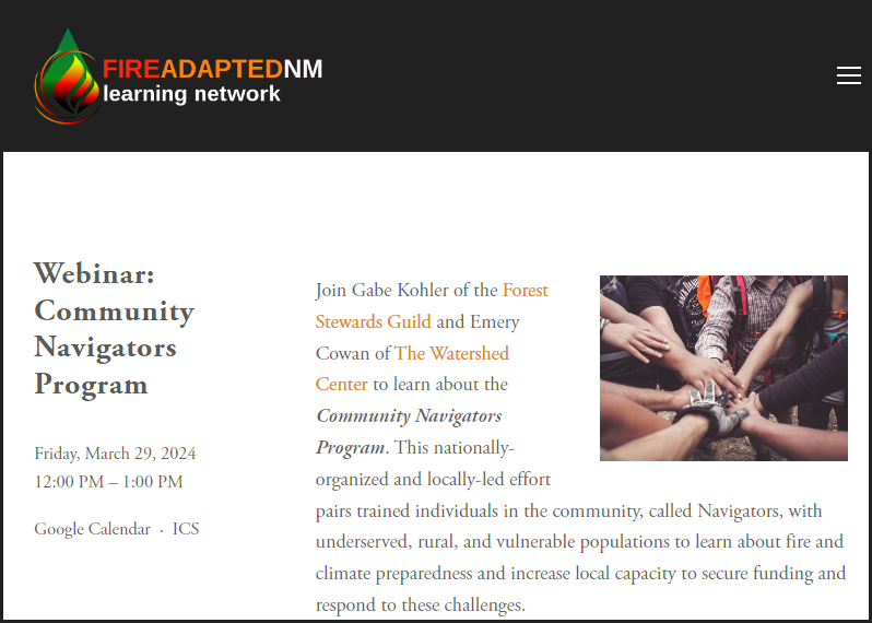
Friday, March 29 from 12:00-1:00pm: What is the Community Navigators Program?
FACNM is launching its spring webinar series on March 29th! Join Gabe Kohler and Emery Cowan as they introduce the national and regional intent of the Community Navigators Program and discuss how communities across the state can access this resource. Learn more by visiting the FACNM Events page!

Tuesday, April 16 from 12:00-1:00pm: Community Wildfire Protection Plans
Join NM Forestry Division and The Ember Alliance to hear about CWPPs - the basics, importance of, resources and support for, and relevance to county ordinances and homeowners insurance - during the second webinar in FACNM’s spring series.

Wednesday, May 22 from 1:00-2:00pm: Home Hazard Assessments: Back to Basics
Join NM Forestry Division and The Ember Alliance to hear about CWPPs - the basics, importance of, resources and support for, and relevance to county ordinances and homeowners insurance - during the second webinar in FACNM’s spring series.

Review the entire series at www.facnm.org/events or by downloading the flyer!
View our archive of webinar recordings anytime by visiting the FACNM YouTube page!
Cal FSC Webinar Series

April 2024: Fire Use Around the World: Purposes, Principles, Policies, and Practices
In this webinar series from the California Fire Science Consortium, a survey of prescribed fire from around the globe is presented. It focuses on seven topic areas: fuel management; rangeland and landscape management; management of production forests; wildlife management; monitoring and datasets; and ecological restoration and cultural fire.
……….
Resources for Community Wildfire Defense Grant (CWDG) applications
Cycle 3 of the Community Wildfire Defense Grant program will open in mid-2024. For organizations and collaboratives interested in applying, some resources have become available. These resources are subject to change and will be updated throughout the spring and summer as the CWDG deadline approaches.
forestrygrants.org provides access to CWDG Cycle 1 and 2 applications that were awarded or scored high.
Recordings of grant-writing workshops that provide more context, questions, and conversations are available on the New Mexico Forestry Division Facebook page
Wildfire risk
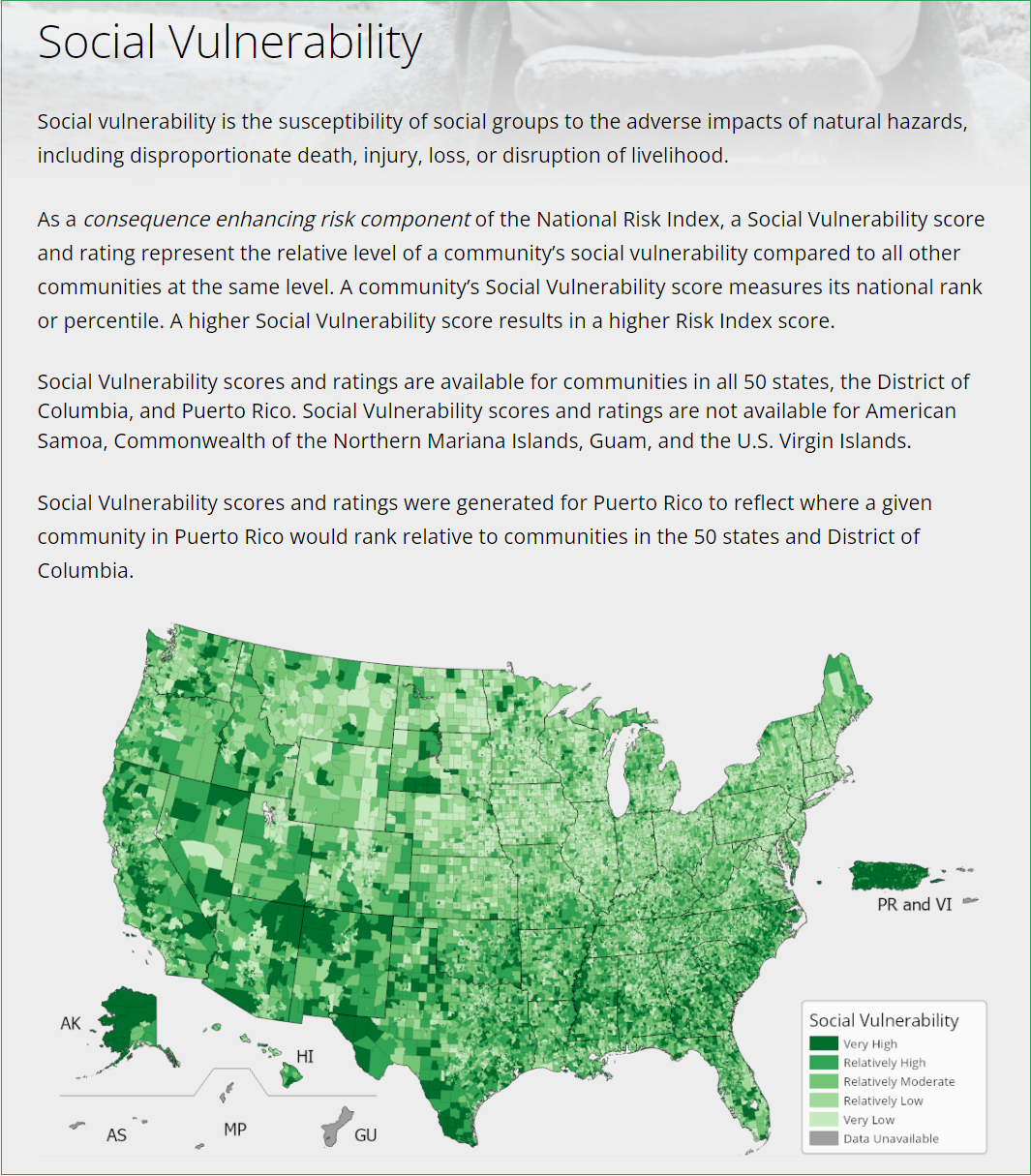
View New Mexico's Communities At Risk to determine the risk rating for your area of interest.
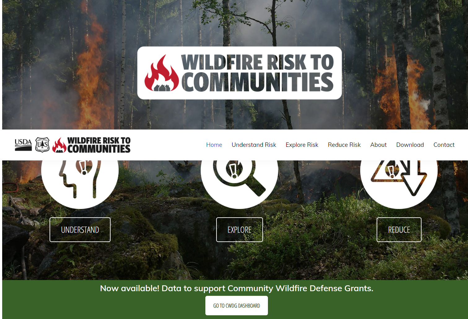
Verify and cite the risk status of your area of interest through wildfirerisk.org.
Access Forestry Division’s New Mexico Forest Action Plan. The objectives and goals outlined in this document should be referenced in CWDG applications from New Mexico.