Happy Wednesday, FACNM Community!
Wildfire risk does not exist in a vacuum; many factors contribute to how vulnerable an area or a community is to a potential fire. Proximity to wilderness, ecosystem type, defensible space, building materials and styles, financial standing, digital connectivity, and more influence severity of risk. Today we will be exploring one aspect of this intersectional risk - social vulnerability - and how we can account for it in our community protection planning.
This Wildfire Wednesday features:
Take care,
Rachel
Learn more about the Social Vulnerability Index!
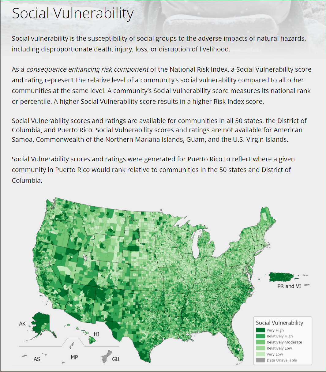
The Social Vulnerability Index
From water shortages to wildfire impacts, research and experience has shown that socially vulnerable groups across the United States are bearing high costs of environmental hardships which are expected to worsen with climate change, population growth, and changes in population centers and habits. Growing evidence indicates that these environmental hardships constitute an environmental injustice, as vulnerable groups are disproportionately exposed.
In the face of wildfires, all communities risk tremendous losses. However, some communities risk losing more of their assets, both tangible and cultural, when their homes or their properties burn. Many rural and under-served communities have no insurance to rebuild their homes; renters are displaced and have no means to recover their valuables; and elderly and disabled residents confront additional threats when responding to events and caring for themselves and their families. Catastrophic wildfire can result in the loss of livelihood for residents and communities as a whole, including loss of jobs, natural resource and tourism industries, and other economic opportunities in the community.
The social vulnerability index refers to the susceptibility of social groups to the adverse impacts of natural hazards. For wildfire, this index can be mapped by overlaying wildfire potential, wildland-urban interface designations, and census tract data. On average, places with high wildfire potential have lower social vulnerability, but nearly 10% of all housing in places with high wildfire potential also exhibit high social vulnerability.
Learn more about tools for evaluating social vulnerability!
Tools for Evaluating Vulnerability
Wildfire Risk to Communities
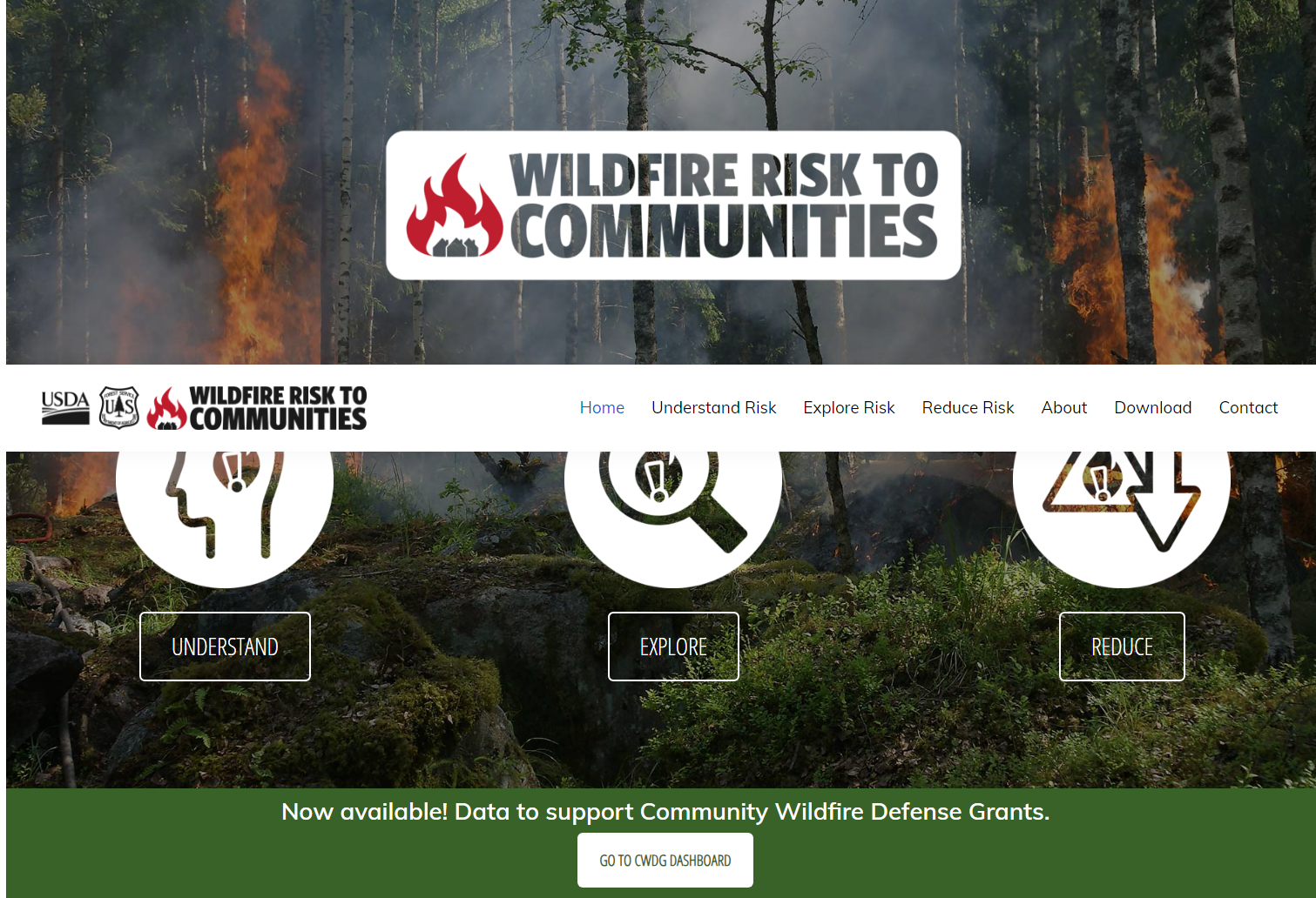
"Wildfire Risk to Communities" is a user-friendly website developed by the USDA Forest Service to aid communities in comprehending and decreasing their vulnerability to wildfires. This platform, established at the directive of Congress, offers interactive maps, charts, and resources to support informed decision-making. Utilizing the most up-to-date research insights, the website identifies and assesses wildfire vulnerability, equipping communities with the necessary tools to manage and mitigate these risks. The data used in the project is drawn from consistent sources like LANDFIRE for vegetation and fuels, the National Weather Service for weather information, and the U.S. Census Bureau for community data. Notably, wildfires and significant disturbances that happened after 2014 are not yet included in the data.
The website is primarily designed for community leaders such as elected officials, planners, and fire managers. It provides a broad perspective on risk across regions, states, and counties. While accessible for exploration online, the data can also be downloaded as GIS raster layers which enables more in-depth and personalized analysis. The website is intended to be used to compare risk among communities rather than within them and is not suitable for evaluating risk at the local, neighborhood, or individual home level. It also features a tool specifically intended for use with Community Wildfire Defense Grant (CWDG) applications.
Justice40 Initiative
Through Presidential Executive Order 14008, the Federal Government has set a goal to have 40% of overall benefits of certain Federal investments flow to disadvantaged communities that are marginalized, underserved, and overburdened by pollution. The categories of investment that fall within the Justice40 Initiative are: climate change, clean energy and energy efficiency, clean transit, affordable and sustainable housing, training and workforce development, remediation and reduction of legacy pollution, and the development of critical clean water and wastewater infrastructure.
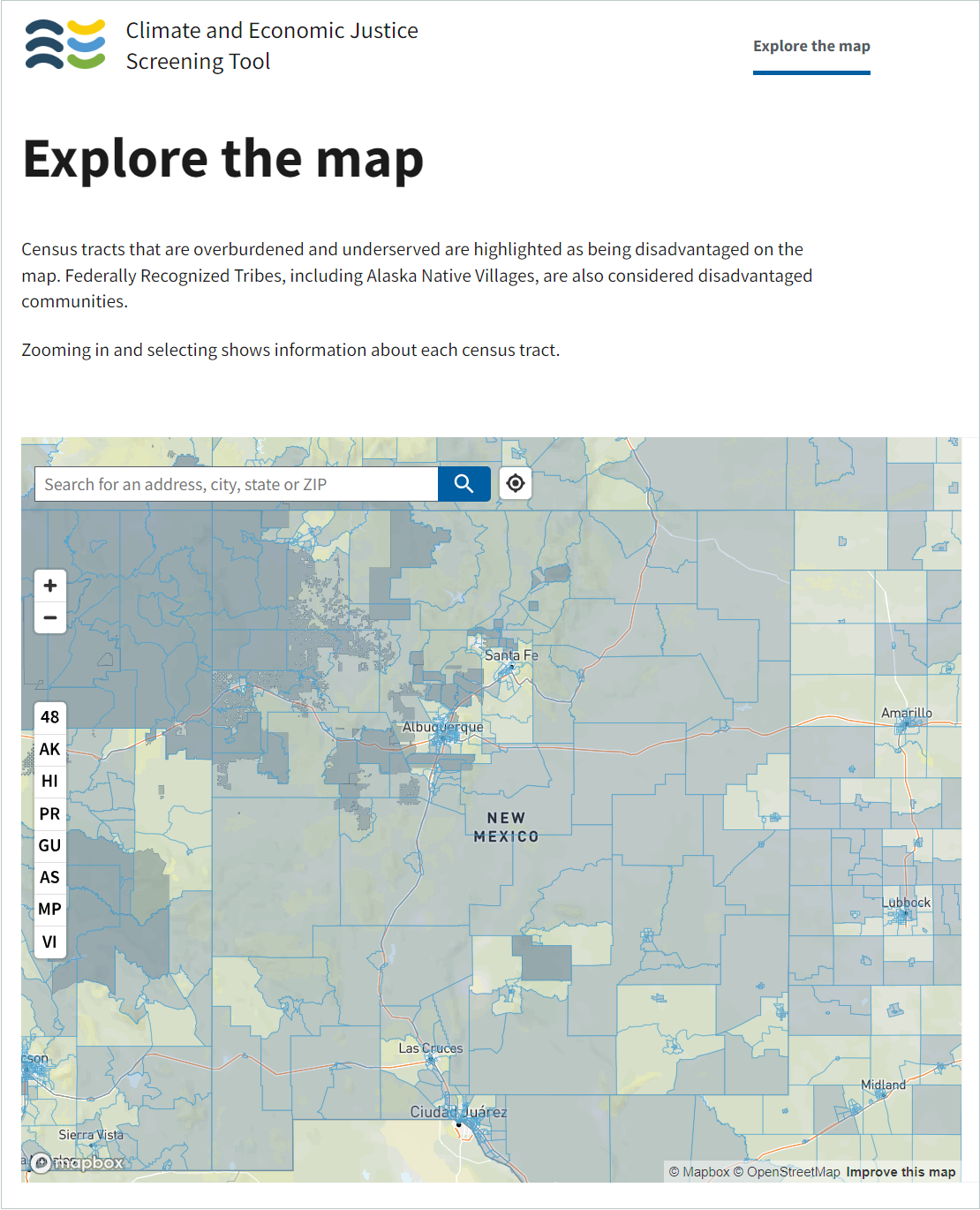
In July 2021, the White House issued formal Interim Implementation Guidance directing all Federal agencies to identify which of their programs are covered under the Justice40 Initiative and to begin implementing a set of reforms to those programs. In January 2023, the White House issued additional guidance to Federal agencies on how to use the Climate and Economic Justice Screening Tool (CEJST), a geospatial mapping tool that helps bring disadvantaged communities to the forefront of planning. Initiatives like J40 are designed, in part, to create more equitable distribution of wildfire risk reduction costs and benefits.
The CEJST is a designed to identify communities that are marginalized and overburdened by pollution and underinvestment. The CEJST features a user-friendly searchable map that identifies disadvantaged communities across all 50 states, the District of Columbia, and the U.S. territories, to the extent data are available for the U.S. territories.
Engagement in Community Wildfire Protection Plans
Since the advent of the National Fire Plan in 2000, numerous policies and programs, including the Healthy Forests Restoration Act and Community Wildfire Protection Plans (CWPP), have been implemented for communities across the nation to work collaboratively with public agencies to identify and reduce wildfire risk. Beginning in 2005, collaborators within New Mexico determined the need to incorporate provisions within these CWPPs to account for and uplift socially vulnerable - rural, low-income, and under-served - communities. Papers such as Measuring Community Capacity for Protection from Wildfire recognized that some of these communities lack the human capital (staff or volunteers) and social capacity (including financial resources) to successfully develop and implement CWPPs on their own.
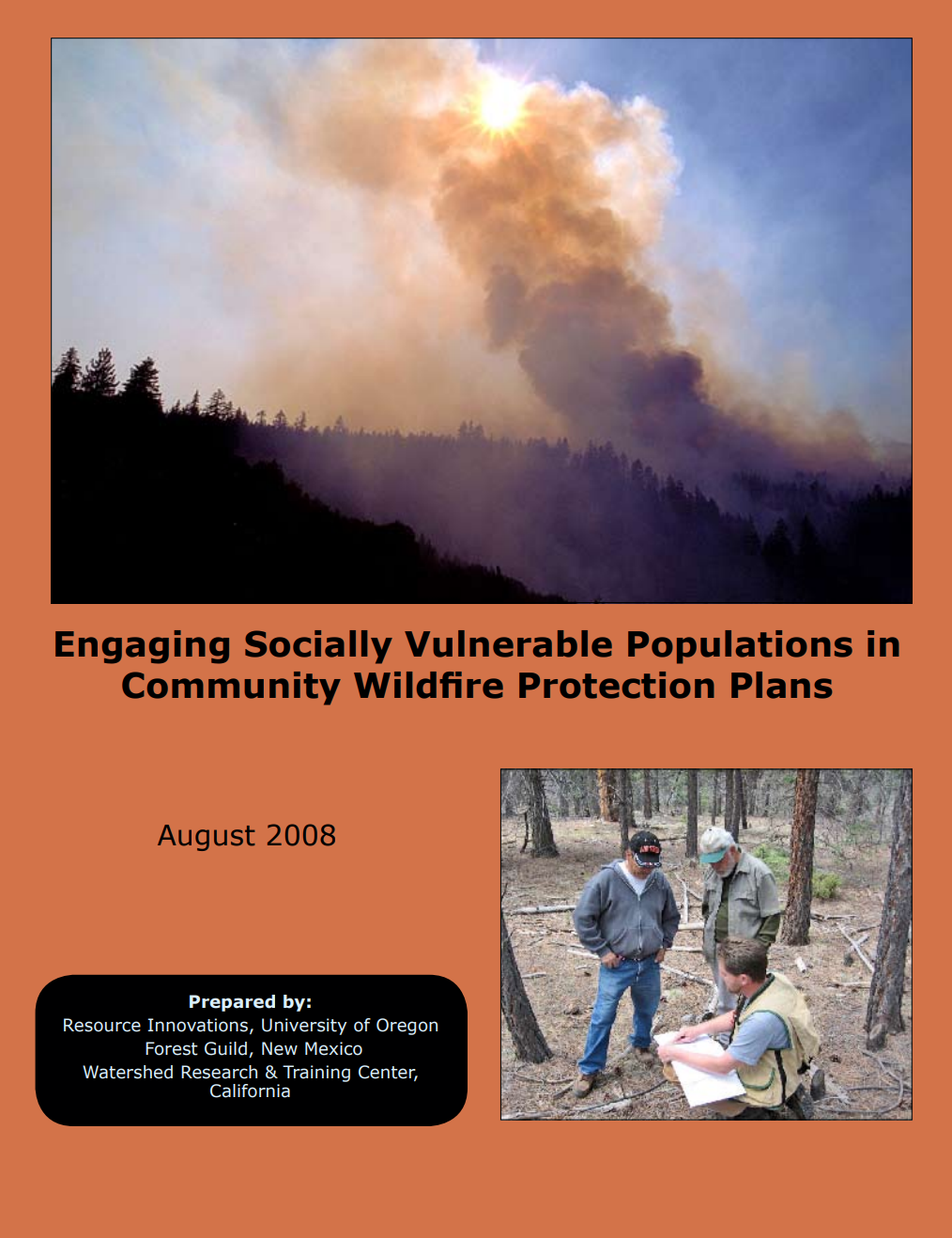
Technical assistance and direct education and outreach can make a great difference in assisting these communities identify high risk areas and recommend strategies for fire protection. A 2008 document, Engaging Socially Vulnerable Populations in Community Wildfire Protection Plans, provides tools to low-income and under-served communities for protection from wildfire:
Ensure that low capacity communities are incorporated within Community Wildfire Protection Plan (CWPP) goals.
Conduct risk assessments that include social as well as biophysical dimensions of risk.
Identify vulnerable populations and develop strategies to meet their needs within a CWPP.
Monitor and evaluate the impact of CWPPs.
Topics covered include CWPP strategies for low capacity communities, Fostering collaboration, Assessing community capacity in a wildfire risk assessment, and Vulnerable populations.
Following the publication of this 2008 guidance, the NM Forestry Division incorporated the recommendation that CWPPs “recognize the needs of especially vulnerable populations such as the elderly, people with disabilities, and disadvantaged populations” in their 2015 and 2021 CWPP Guidelines. This practice is now standard for the creation and updating of Community Wildfire Protection Plans across the state.
Digital vulnerability during disasters
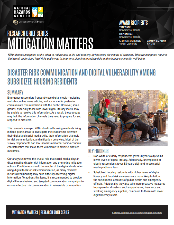
The Disaster Risk Communication and Digital Vulnerability Among Subsidized Housing Residents report details how some groups may lack the information they need to prepare for and respond to disasters because they are unable to receive digital risk communication due to internet access barriers or lower levels of digital literacy skills. It suggests that practitioners should be more cautious when using digital tools to disseminate information, as many individuals in subsidized housing may have difficulty accessing digital information. The report also provides recommendations to ensure the effectiveness of risk communication in vulnerable communities such as digital literacy training and targeted communication campaigns. Read the report in full and peruse the research brief.
Learn more about Resources and Opportunities!
Resources and Opportunities
Webinars

February 20 at 12pm: Post-Wildfire Recovery Through the Principles of Engineering With Nature
In this one-hour webinar from the Southwest Fire Science Consortium and Joint Fire Science Program, Chris Haring with the Army Corps of Engineers will share lessons learned from post-fire erosion control and ecosystem recovery following the Las Conchas fire in Santa Clara Canyon. Chris’ experience centers around Engineering With Nature-Natural and Nature-Based Features (EWN-NNBF), using post-fire debris and existing materials to stem erosion and degradation of the canyon and its drainages.