Stage 1 Fire Restrictions for Santa Fe National Forest

Due to elevated wildfire risk, the Santa Fe National Forest has implemented Stage 1 Fire Restrictions (Order # 03-10-00-26-03) forest-wide beginning Thursday, April 2, 2026, through September 30, 2026.   

The decision to implement fire restrictions is based on various factors, including the availability of firefighting resources, current drought conditions, weather forecast, the time of year, and fuel moisture levels. Implementing fire restrictions can help prevent human-caused wildfires and protect public health and safety.  

What is prohibited under Stage 1 Fire Restrictions?  

  • Building, maintaining, or using a fire, including charcoal and briquettes outside of a designated fire ring or grill provided by the Forest Service in a developed recreation area. Stoves, lanterns or heaters fueled by propane or other liquefied petroleum fuels may be used forest-wide in areas cleared of flammable materials within three feet of the device, if they meet manufacturer’s safety specifications and have on/off switches.   

  • Smoking is only allowed in enclosed vehicles or buildings and developed recreation sites.    

See the full Forest news release below:


Wildfire Wednesdays #179: Red Flag Warnings, Fire Restrictions, and Burn Bans Explained

Happy Wednesday Greater Santa Fe Fireshed Coalition!

When weather conditions turn hot, dry, and windy, the risk of a single spark igniting a wildfire increases dramatically. During these periods of elevated fire danger, fire professionals and land management agencies rely on several tools to inform the public about the risk and outline actions that can help prevent human-caused fires. Terms like Red Flag Warning, stage restrictions, and burn bans are being used more frequently as prolonged drought, dry fuels, and extreme weather become more common. Earlier this month, parts of the Cibola National Forest and National Grasslands implemented Stage II fire restrictions, highlighting how quickly conditions can shift across the region. While these terms are often used together, they serve different purposes.

Below, we break down what each designation means, how they are determined, and the types of restrictions or precautions that may accompany each notice. By knowing why these measures are implemented, communities can make safer decisions, follow local regulations, and help reduce the risk of human-caused wildfires during periods of elevated fire danger.

This Wildfire Wednesday features:

All the best,
Megan


Red Flag Warnings

What is a Red Flag Warning?

The origin of the name, Red Flag Warning, is a literal one, according to Tamara Wall of the Desert Research Institute: “If there was… high fire danger, local fire stations would go and run a red flag up the flagpole. It was a very visual, kind of pre-mass communications way to signal to people in the area that it was a high-danger day” (NPR, 4/14/23).

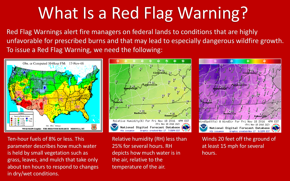
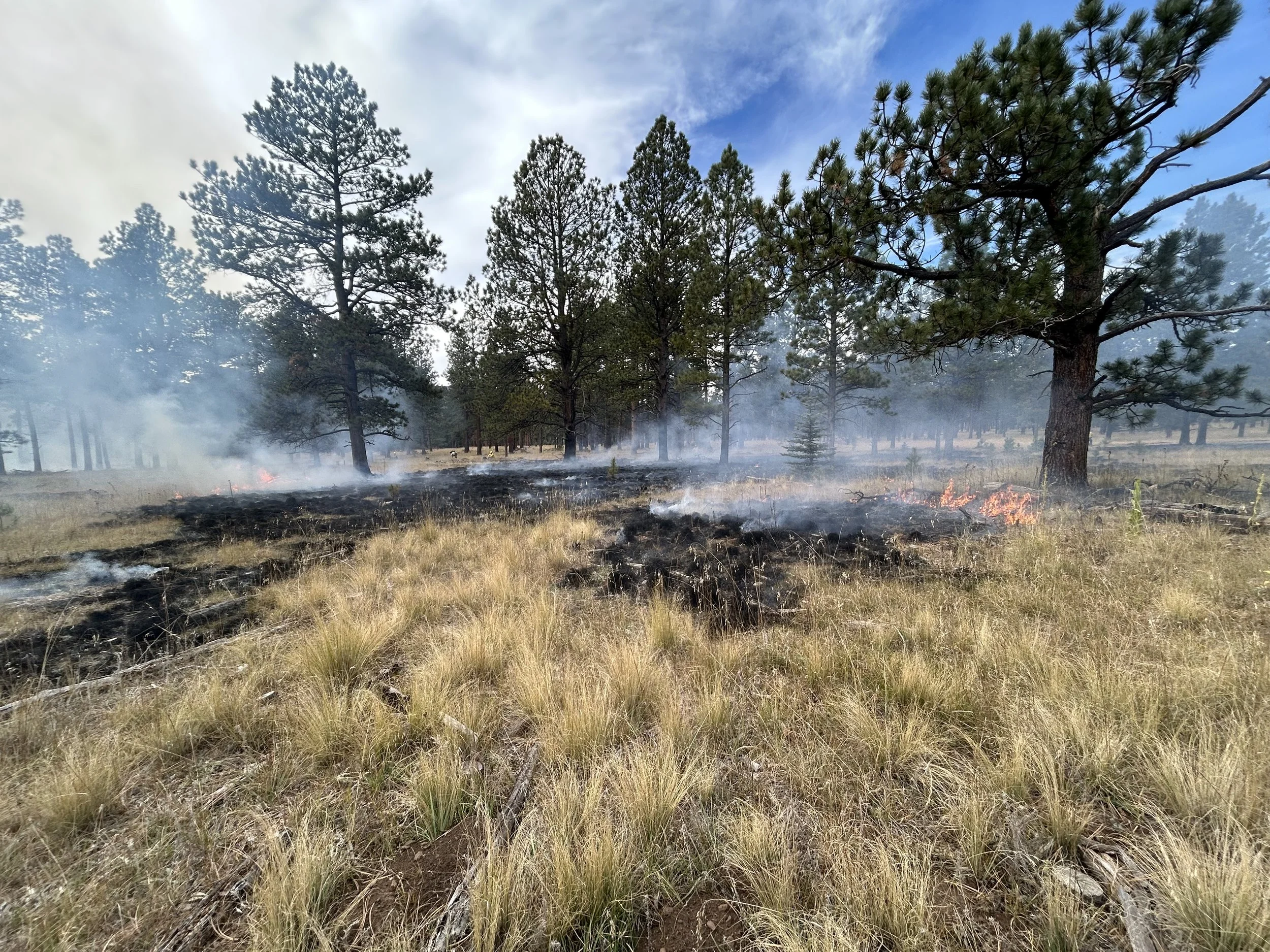
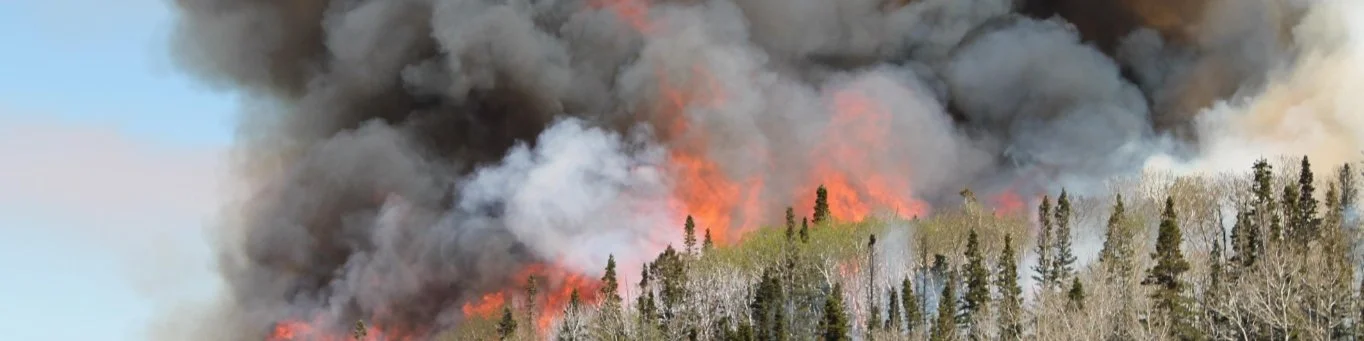
According to the National Weather Service (NWS), which issues these alerts in conjunction with local and state agencies, a Red Flag Warning is part of a weather forecast which indicates a local increase in fire danger risk in the next 12 to 24 hours. This increased risk is due to a combination of critical fuel conditions and critical weather conditions (warm temperatures, very low humidities, and strong winds). This means that if a wildfire starts, the conditions are right for it to spread rapidly and be difficult to contain.

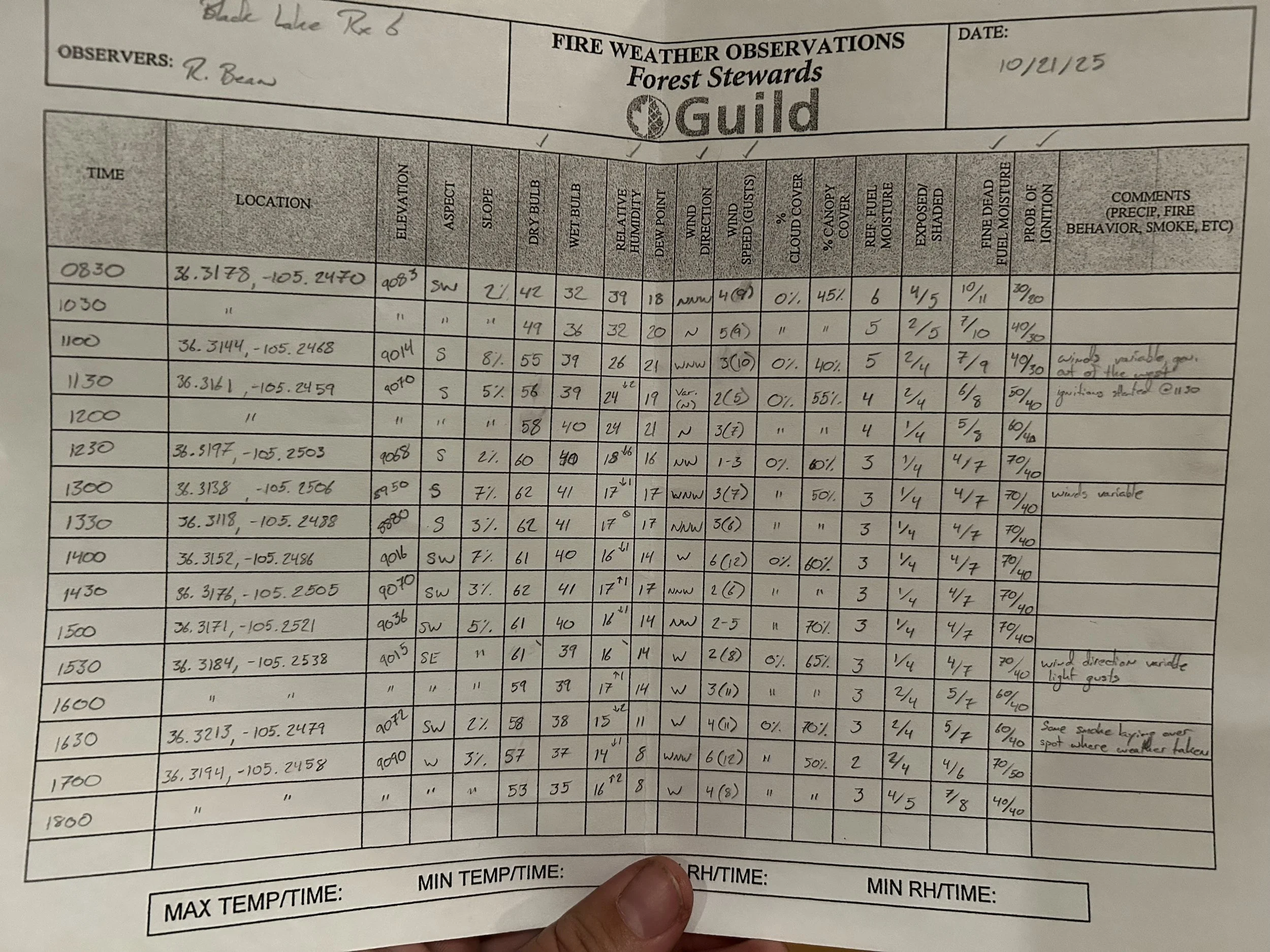
This combination of 1. low relative humidity (RH), 2. strong surface wind, 3. unstable air (an incoming or outgoing storm system that creates a significant temperature differential between the land surface and lower atmosphere), and 4. drought creates critical fire weather (NWCG, Critical Fire Weather). When it comes to issuing a Red Flag Warning, primary criteria include relative humidity of 15% or less combined with sustained surface winds, or frequent gusts, of 25 mph or greater. Both conditions must occur simultaneously for at least 3 hours out of a 12-hour period, according to the National Weather Service. Meteorologists also consider how all forecasted weather elements combine to create hazardous conditions (e.g. moderate humidity combined with high temperatures and high winds), even if they don’t fit the humidity and wind criteria individually.

When you see a Red Flag Warning, it means that critical fire weather is currently or will soon be occurring. Red Flag Warnings differ in timing from a fire weather watch, which is a longer-term forecast that warns of the possible development of Red Flag conditions in the next 72 hours. Fire Weather Watches may be issued with meteorologists forecasting up to 8 days in advance, whereas Red Flag Warnings are only issued when the critical fire weather conditions meeting the criteria for these Warnings are expected to begin in the next 12-24 hours.

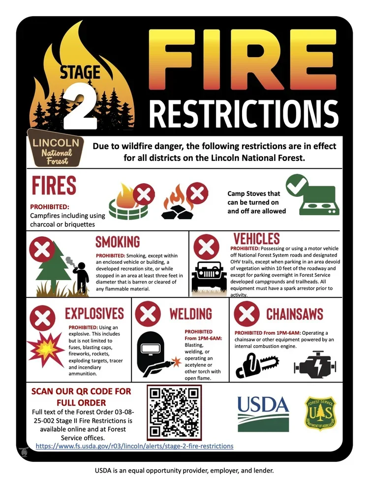
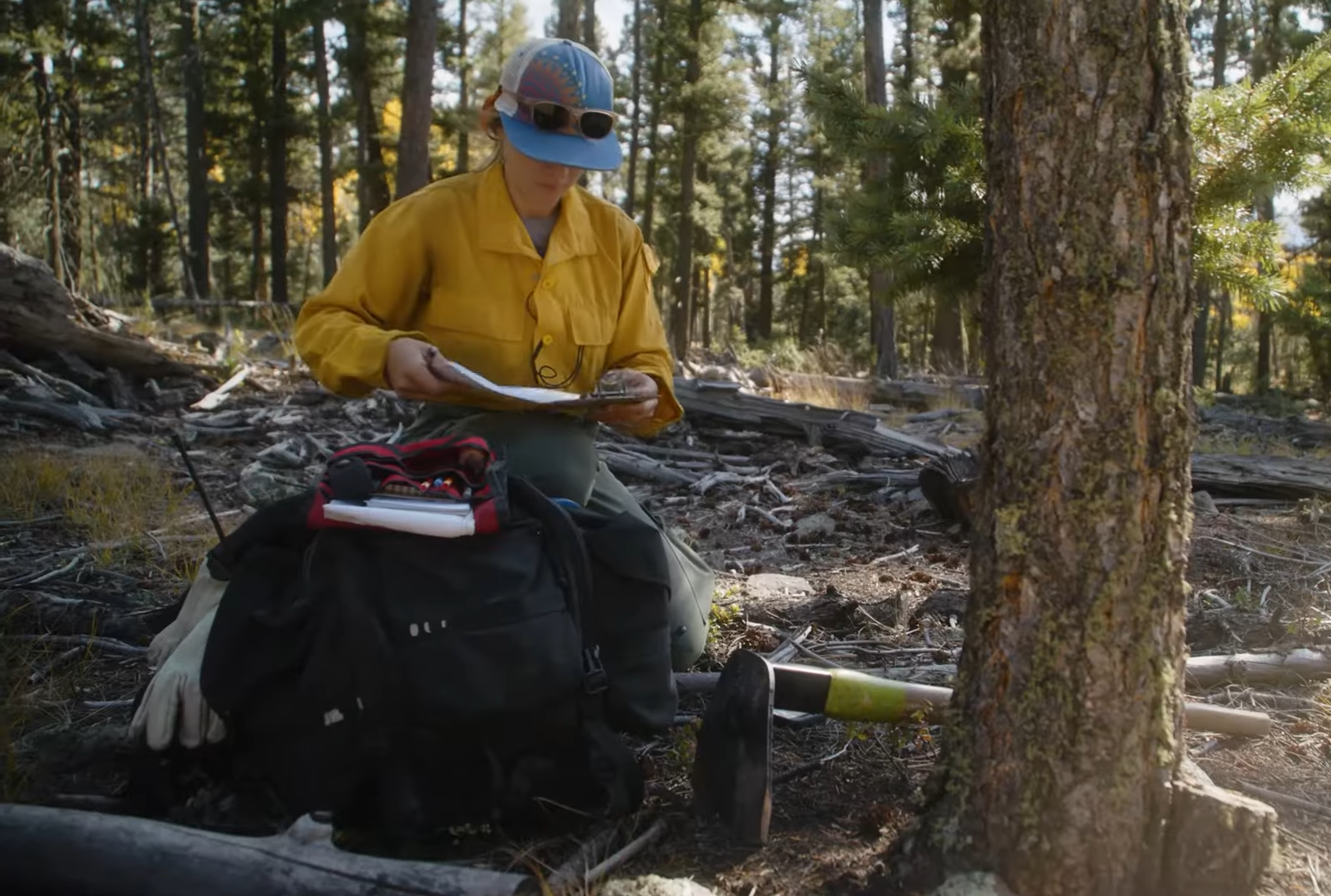
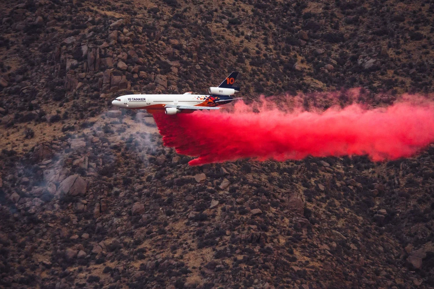
The alert announcing a Red Flag Warning, whether online, on the news, or on your weather app, will usually indicate for how long the Red Flag Warning is forecasted to last. Fire management personnel take Red Flag Warnings into account and may respond by changing staffing numbers or preemptively moving resources into a certain region to be prepared for a potential ignition. During extended periods of high risk, local authorities may consider policy decisions like banning campfires or closing specific areas.
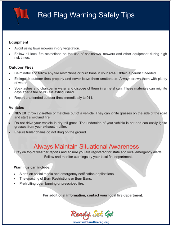
How to Respond

Adjust your behaviors accordingly to avoid creating a spark that could ignite a larger fire.

  • DO NOT burn debris piles.

  • If you are allowed to burn in burn barrels in your area, cover them with a weighted metal cover.

  • DO NOT throw cigarettes or matches on the ground or out of a moving vehicle.

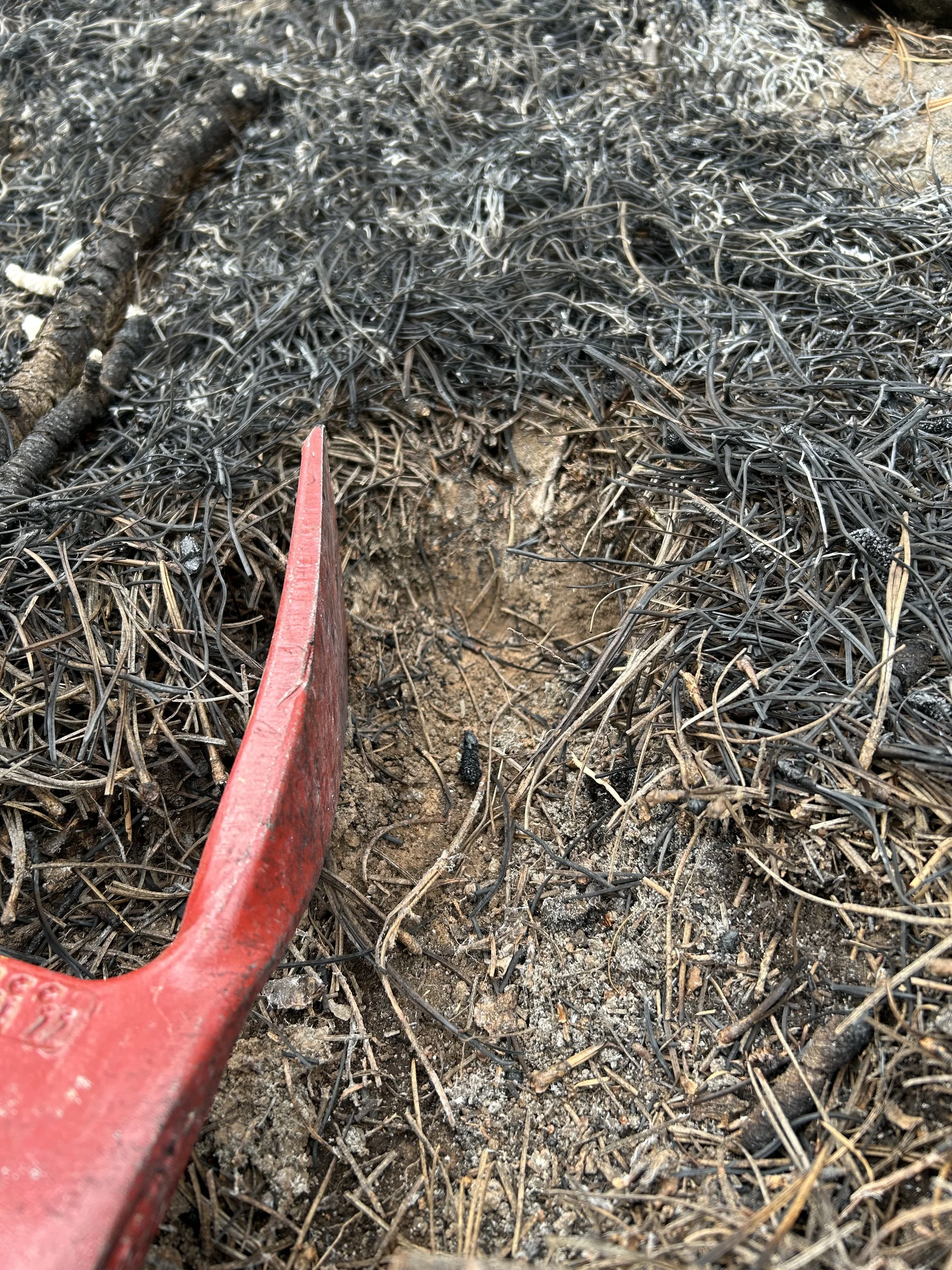
  • If outdoor fires are allowed, make sure to extinguish them properly. Drown fires and charcoal with plenty of water and stir with a shovel to make sure everything is cold to the touch with bare skin.

    • Never leave a fire or barbeque unattended. Sparks or embers can blow into leaves or grass, ignite a fire, and quickly spread.

  • Avoid parking a recently driven vehicle on dry grass or other areas with vegetative cover.

  • Ensure that no chains or hanging metal are dragging from your vehicle or tow-behind trailer which could cause a spark.

Fire Restrictions

What are fire restrictions?

In the U.S., fire stage restrictions are a set of regulations that come in three tiers to limit activities and possibly even access to segments of public land (e.g., a national forest or ranger district) during periods of high fire risk. Fire restrictions are put in place by land managers to reduce the risk of human-caused wildfire ignitions during periods of high fire danger and severe weather conditions. The decision to implement fire restrictions is based on various factors, including the availability of firefighting resources, current drought conditions, weather forecast, and fuel moisture levels. On national forests, managers may consider implementing restrictions if at least three of the following conditions are present: (1) 1,000 hour fuel content is in the 90th percentile or above; (2) three-day mean energy release component (a measure within the NFDRS that determines potential heat that could be released if fuel was burned, indicating a fire might be hotter and harder to suppress) is at the 90th percentile or above on the forest or district’s dominant fuel type , (3) live fuel moisture content is 75% or less, (4) wildland fires are impacting available suppression resource capacity; (5) the area is receiving a high occurrence of wildland fire, and (6) adverse fire weather is predicted to continue (NIFC, 2021).

Managers often coordinate with state, county, and federal partners to implement fire restrictions, but because different agencies manage different lands, restrictions may not always align across boundaries. For example, a national forest may be under restrictions while nearby county or municipal lands are not. It is worthy of noting, different agencies and entities may also use different criteria or require different approval processes to implement stage restrictions, so visitors should always check the rules for the specific area they plan to visit.

Below are the three stages of fire restrictions and the common prohibited activities initiated by these restrictions on federal lands. Local variations on prohibited activities may exist.

Stage 1

Stage 1 fire restrictions reduce wildfire risk while allowing limited recreation.

Typically prohibited (unless otherwise specified):

  • Building, maintaining, attending, or using campfires, charcoal grills, or other open fires except in designated, developed recreation sites

  • Smoking, except inside an enclosed vehicle or building, within a developed recreation site, or in an area at least three feet in diameter that is cleared of all flammable materials

  • Operating chainsaws or similar equipment without a USDA- or SAE-approved spark arrester

  • Welding or using acetylene torches or other open-flame devices outside of cleared areas (usually at least 10 feet in radius)

  • Discharging fireworks

Generally allowed:
Portable stoves, lanterns, and heaters fueled by propane or other liquefied petroleum fuels, provided they are used in cleared areas and meet manufacturer safety specifications with an on/off switch.

Stage 2

Stage 2 fire restrictions further limit ignition sources during very high fire danger.

Lincoln National Forest Stage 2 Fire Restrictions - May 2025

Typically prohibited (unless otherwise specified):

All campfires, charcoal grills, and open fires on federal lands

  • Smoking, except in an enclosed vehicle or building, a developed recreation site, or in a cleared, nonflammable area

  • Discharging fireworks or using explosives

  • Operating motor vehicles off designated roads (except in developed parking areas or trailheads)

  • Operating equipment powered by internal combustion engines (such as chainsaws) without a spark arrester, or using equipment that produces open flames (e.g., welding); some activities may be restricted to specific hours

Generally allowed:
Portable stoves and lanterns using gas, jellied petroleum, or pressurized liquid fuel, as well as fully enclosed wood-burning stoves with proper spark arrester screens.

Stage 3

While the stage restriction system is used for both public and private lands depending on the authorizing entity, stage 3 restrictions are only used on public lands. Stage 3 restrictions involve full closure of a forest or designated area. During a closure:

  • All roads, trails, and access points may be closed

  • Public entry and recreation are prohibited

  • All activities, regardless of type, are suspended until conditions improve

These closures are implemented only when fire danger is extreme and continued public access would pose significant safety risks or hinder firefighting operations.

Southwest Area Fire Restrictions Interactive Map

New Mexico Forestry Division put together a dashboard to provide the public with a real-time map showing current fire restrictions on public lands in the Southwest. Map data is compiled from various sources and mostly displays federal and state lands, with county restrictions reflected when provided. You should contact your local fire department or government agency for the latest fire restriction information.

Fines and Penalties

Once fire restrictions are in effect, violation of prohibited activities may result in citations, fines, or criminal charges. It is important to not however, that penalties may vary depending on the agency and jurisdiction enforcing the restrictions.

On lands managed by the U.S. Forest Service, violating stage restrictions is generally considered a misdemeanor. Penalties include a fine of up to $5,000, imprisonment for up to six months, or both.

Local jurisdictions in New Mexico may impose different penalties. For example, on county-managed lands in Los Alamos County, a person found in violation of fire restrictions may receive a written citation and face criminal penalties, but no explicit fine amount is listed in their order. In contrast, within the City of Albuquerque, violations of fire restrictions may be punishable by a fine of up to $500, imprisonment for up to 90 days, or both.

Burn Bans

Burn bans are another tool agencies and fire administrators use to prevent wildfires and protect public safety during dry weather and high-fire risk conditions. Burn bans, also known as open burning restrictions, are temporary regulations that limit or prohibit outdoor burning activities such as campfires, bonfires, burning yard waste, agricultural burns, and the use of fireworks. Depending on the severity of conditions, some bans may still allow certain low-risk activities, like cooking with propane grills or using enclosed stoves, while stricter bans prohibit nearly all open flames. Essentially, a burn ban means that outdoor burning is restricted or prohibited within a designated area to reduce the risk of accidental fires spreading.

Burn bans are typically enacted due to factors like drought, low humidity, dry vegetation, high winds, and elevated temperatures, all of which significantly increase wildfire potential. These restrictions are usually issued by local or county governments, as seen in Colfax County, which recently issued a burn ban placing several fire districts under restriction. They are temporary and remain in effect until weather conditions improve and fire danger decreases. Public notices, official county websites, and local fire agencies typically provide updates on current burn ban status, exemptions, and enforcement details.


Additional Resources and Upcoming Opportunities

New Mexico Fire Adapted Funding Library

Did you know there’s a dedicated funding library created specifically for New Mexico community leaders, landowners, and wildfire practitioners? The New Mexico Fire Adapted Funding Library helps users quickly identify potential funding sources for wildfire adaptation, risk reduction, and post-fire recovery efforts.

The library features funding opportunities, direct links for additional details, and a sortable feature that allows you to filter by eligibility type. There are currently 12 open funding opportunities accepting applications, and the database is updated regularly as new programs become available.


As Southwest Wildfire Awareness Week (March 23–27) and National Wildfire Preparedness Day (May 2) approach, community leaders and fire practitioners are gearing up to host events and create meaningful opportunities to engage their communities. The Oregon State University Extension Fire Program has developed a helpful primer focused on engaging adult community members at the local level in wildfire preparedness efforts. The guide offers practical strategies for planning inclusive engagement activities, tailoring outreach to different adult learning styles, and incorporating trauma-informed approaches to better support the whole community.

For those organizing preparedness events this spring, this resource provides thoughtful, research-based guidance to strengthen outreach and impact!

Continued pile burning at Glorieta Camps

Glorieta Camps Winter Pile Burning to Continue with Arrival of Snow on January 25th

Glorieta Camps and the Forest Stewards Guild plan to take advantage of favorable weather conditions and continue prescribed pile burning at Glorieta Camps on Sunday, January 25, 2026. This burn will be implemented by the All Hands All Lands Burn Team’s Pile Squad, a program of the Forest Stewards Guild.

Up to 74 acres of piles will be treated with hand ignitions by trained and qualified firefighters working within the parameters of an approved and permitted burn plan. All burn operations will occur with snow on the ground and piles will be patrolled until they are completely out. This prescribed pile burn is a part of a long-term and science-based commitment by Glorieta Camps to improve forest health and reduce the risks wildfire poses to communities, forests, and watersheds.

Smoke and flames may be visible due to the proximity of the site to I-25 and Glorieta. Smoke may be visible from Pecos, La Cueva, and Eldorado. The Forest Stewards Guild works closely with the New Mexico Environment Department (NMED) and the New Mexico Department of Health (NMDOH) to monitor air quality during the burn and limit the severity of smoke impacts. This prescribed burn is happening in the context of the Greater Santa Fe Fireshed Coalition landscape. The Fireshed Coalition supports a HEPA Filter Loan Program so that smoke sensitive individuals can borrow a filter for the duration of the impacts.

An employee of Glorieta Adventure Camps uses a drip torch to light a pile.

Click here for the full press release.

Want to learn more?

Wildfire Wednesday #176: Evaluating the Effects of Fire (FEMO)

Happy Friday, Fireshed folks!

Land managers, fire personnel, private landowners, and others all work, in varying capacities, to care for the land under their jurisdiction. However, caring for the land can mean different things, to different people, in different places. We live in a fire-adapted environment, so fire (prescribed or wildfire) is one consideration when thinking about caring for and managing the land.

It all begs the question - how do we understand the effects of our land management decisions? How do we improve our management of wildfire, intentional fire, and fire-adapted ecosystems? This is where monitoring (observing and tracking changes in ecosystems over time) and observations-based adaptive management comes in. For fire specifically, we can monitor fire effects (the way that fire changes the area it burns through) to understand the conditions and tools used to influence fire outcomes. Today’s newsletter dives deeper into the what, where, and why of Fire Effects Monitoring.

This Fire Friday features:

Be well,
Rachel


Fire Effects Monitoring: the Basics

What is Fire Effects Monitoring?

A visualization of the adaptive management cycle.
Illustration credit: National Park Service.

Fire effects monitoring is a term used to describe the observation and evaluation of landscape conditions before, during, and after fires. It helps us understand how those fires impact ecosystems, assess management effectiveness, ensure firefighter safety, and guide future land management decisions (a process called adaptive management).

Why is it done?

  • Safety: observations provide real-time information on fire behavior, spread, perimeter location, and changing conditions that can impact these things for tactical decisions during burns.

  • Effectiveness: monitoring measures ecosystem health, damage, and benefits over time, providing unbiased data that can be used to evaluate if fires meet hazardous fuel reduction/ecological goals or otherwise improve ecosystem health and function.

  • Knowledge: knowing real-world fire effects provides actionable data and lessons learned for adaptive management, providing suggestions for improvement on future burns.

Who does it?

A fire effects monitor records on-site weather data (temperature, relative humidity, wind, etc.) prior to ignitions on a prescribed burn. Having up-to-date weather and conditions information allows burn managers to make the best decisions about how, where, and if to light a burn. In this photo, a red pocket kit with scientific tools for measuring weather parameters can been seen sitting on top of the FEMO’s fire pack.

Fire Effects Monitoring Officers (FEMOs), also called Fire Effects Monitors, collect data to inform their team’s understanding of what fire is doing and changing on the ground and help managers assess safety and achieve objectives. They are individuals who have experience with fire and have received training on how to measure and evaluate the different metrics necessary to determine fire effects. Depending on their affiliation, these Monitors will follow different Fire Effects Monitoring protocols and focus on collecting different data. For example, Monitors with the National Park Service regularly and frequently collect in-depth environmental data from specific locations (called plots), allowing them to directly compare pre-fire conditions to post-fire measurements (check out the NPS monitoring handbook for more information). Monitors with the U.S. Forest Service generally focus on providing their personal observations of wildfires to their module leader, crew boss, or other fireline supervisors to inform safety, suppression, and tactical decisions. Monitors with nonprofits, universities, and other organizations will tailor monitoring protocols to their unique needs, or the needs of each individual burn (e.g. focusing on smoke observations during a prescribed burn to ensure that nearby communities are not being unnecessarily impacted).

What is collected?

FEMO data collection can include measurements of fuel (amount and condition of flammable material), fire behavior, weather, smoke, and environmental effects on vegetation and fuels. On wildfires, monitoring helps maintain tactical situational awareness for the safety of fire crews and determine whether the team is achieving incident goals. On intentional (prescribed or controlled) burns, monitoring helps to ensure that fire behavior and effects remain within the range of conditions allowed by the prescription (the fire plan which establishes objectives, desired effects, and allowable fire behavior). Some data, like weather observations and fire behavior and spread, will generally be collected daily for each day that the fire is active, while other data, like measurements of fuel and vegetation moisture or amount of fuel consumed, will be collected less frequently. The type and frequency of data collection is based on incident management needs, reporting requirements, and objectives.


How FEMO Findings Are Used

So what happens to all of this monitoring data?

During a burn, a FEMO’s observations may be used to improve the SPOT weather forecast (a location-specific hourly weather forecast from NOAA) or help the burn boss (individual overseeing a prescribed burn) understand whether they are meeting their burn objectives. This can help the whole team adjust their actions and be immediately reactive to improve outcomes in the short-term (while a fire is ongoing).

An example FEMO report from a prescribed burn in west-central New Mexico. The contents of the report will vary based on landowner needs and the individual writing the report, but they will generally contain maps and background on the burn, objectives and methods, a summary of the burn activities and weather, and detailed information on the burn behavior, smoke, and fire effects.

After a burn, FEMO observations may be summarized into a report which is shared with all incident leaders and partners. FEMO reports provide a clear and fully encompassing written record of a fire’s background, timeline, effects, and lessons learned. They can be referred to after the fact, allowing fire practitioners and managers to see the big picture, learn from their mistakes, and adapt their approach for the next burn, leading to better outcomes in the long term. (e.g. A fire manager might see that fuels reduction objectives were not met because the temperature was low and humidity was high, moderating fire intensity and behavior. From this they could learn that they’ll need to burn that area a little hotter next time to consume the slash and woody debris they want gone.)

FEMO reports can also be shared with external partners and agencies, contributing to collective and collaborative knowledge sharing. As lifelong students of fire there is always something to learn from others’ experiences.


Ecological Benefits of Fire

Periodic, low- to moderate-intensity fire can have many positive effects across ecosystems. Keep reading to learn more or click on any of these resources to dive deeper.

“Cleans” the forest floor

Deep duff, or pine needles and other forest debris, can be seen piled at the base of this fire-adapted ponderosa pine tree following decades of fire suppression and interruption of the natural fire cycle. Reintroduction of fire to these systems can “clean up” the forest, cycle nutrients back into the soil, and help restore resilience to severe fire, drought, and pests and disease.

  • When fire travels through the forest understory, it removes the topmost layer of leaves, needles, and dead or decaying plants. By removing this debris, it opens up space on the forest floor where growth of new plants is encouraged and reduces the amount of fuel that could burn in a future fire, therefore reducing the likelihood of negative future outcomes.

  • Returns nutrients to soil

    The relationship between fire and soil nutrients is complex because of the interactions among many factors. Some soil nutrients will be lost as a low- to moderate-intensity fire consumes organic material in the upper soil layers (greater nutrient losses occurs with higher fire intensity). However, in the long-term fire helps to kickstart the nutrient cycle (the amount of available nutrients in an ecosystem) by increasing soil nutrient turnover rates and redistributing nutrients through the soil profile. For example, soil fertility increases after low-intensity fire as the fire chemically converts nutrients in dead plants that would otherwise take much longer to decay and return to the soil.

  • Increases diversity

    When fire is removed from or suppressed in fire-adapted forests, it leads to over-crowding (trees growing thick and dense) and prevents sunlight from reaching the forest floor, creating intense competition for water and available nutrients. Low- and moderate-intensity fire creates gaps in the canopy, allowing sunlight to filter through and (after several years) increasing the availability of soil nutrients and water. The right kind of fire can also reduce invasive/noxious weed infestations, allowing an opportunity for native plants to grow and establish. Some native species require fire for seed germination!

  • Creates new habitat

    Fire removes thick brush, maintains open meadows, and thins out dense forests, all creating new habitat for animals and birds. Trees that do not survive the fire create new habitat for insects and cavity nesting birds and animals. When a fire burns in a mosaic pattern (burns at variable intensity and severity depending on the terrain and conditions), it creates a diverse patchwork of habitat for different species of wildlife.

  • Kills pests and diseases

    Fire can reduce or eradicate populations of beetles, mites and other harmful pests, reducing disease and keeping forests healthier.

The fire cycle, simplified.
Photo credit: Harvey Mudd College


Additional Resources

Upcoming Webinars

27 January, 12pm MT: Aspen Restoration Using Intentional Fire: A Case Study from Monroe Mountain, UT
This webinar from the Southwest Fire Science Consortium and Southern Rockies Fire Science Network will offer information on an aspen restoration case study from south-central Utah which used high-intensity, high-severity prescribed fire coupled with conifer thinning to improve aspen ecosystem health.

4 February, 11:30am MT: Loss of Old-Growth Forest to Fire
Fire suppression and past selective logging of large trees have fundamentally changed frequent-fire-adapted forests. In this Prescribed Fire for Forest Management series webinar, speaker Scott Stephens will discuss the multiple pathways for achieving success in management of mixed conifer forests, with a focus on the Sierra Nevada Mountains.

10 February, 11am MT: Fuel Break Effectiveness: What Have We Learned So Far?

Jen Croft, Stephen Filmore, Mark Finney, Kit O’Connor, Brad Pietruszka and Erin Belval will be the panelists for this webinar in the USDA Forest Service Research & Development Deep Dive Panel Discussions series. This series is intended for fire, fuels and land managers on critical topics associated with fuels and fire management.

12 February, 1pm MT: Policy Update on the Fix Our Forests Act (FOFA)
This policy update presentation from the Forest Stewards Guild and Southwest Fire Science Consortium will provide insights into the Fix Our Forests Act, including the uptake of wildfire management recommendations to congress and the potential impacts on federal land management agencies and the forests they oversee.

…………………………………………………..

Resources

Annual Round Up: Science You Can Use
2025 marked another year of impactful science from the USDA - Rocky Mountain Research Station. Now, all of their bite-sized and information-packed Science You Can Use bulletins, fact sheets, and more from the past year are available in one place, from bees to beavers and biochar to smoke! To listen instead, you can now stream their science.
Click here to view a multi-year archive of science briefs from the RMRS.

Opinion Article from the NM State Forester: Wildfire prevention costs less than suppression
In this article, New Mexico state forester Laura McCarthy calls wildfire prevention “suppression’s undercover partner” and identifies the three fronts for fire prevention: public awareness and early detection, fuel treatments, and individual defensible space and home hardening action. You can learn about the difference between fire prevention and fire suppression in Wildfire Wednesday #107.

…………………………………………………..

Funding

New Mexico Counties is pleased to announce the 2026-2027 Wildfire Risk Reduction Program. The grant program assists communities throughout New Mexico in reducing their risk from wildland fire on non-federal lands. Funding for this program is provided by the National Fire Plan through the Department of the Interior/Bureau of Land Management for communities in the wildland-urban interface and is intended to directly benefit communities that may be impacted by wildland fire initiating from or spreading to BLM public land. 

 Funding categories include:

  • CWPP updates up to $30,000/project

  • Education and outreach activities up to $20,000/project

  • Hazardous fuels reduction projects up to $100,000/project

The application and checklist are located on the NMC website: https://www.nmcounties.org/services/programs/

Pile burning in the Santa Fe National Forest (Week of Jan. 5)

The Española Ranger District of the Santa Fe National Forest plans to burn piles in the Tesuque Creek area Jan. 8-9th (snow dependent).

After igniting the piles, fire crews will continue work to secure and then patrol the piles over the weekend and beyond. Patrols will continue until no smoke or heat are detected on the unit from hand cold-trailing by on-the-ground crews or infrared technology. The burn will not be declared out until infrared flights detect no heat.

To mitigate smoke impacts, ignitions will end around by mid-afternoon if ventilation is poor.

The purpose of this pile burn is to increase resiliency of the forest to high-severity wildfire as well as drought and insect and disease outbreaks (such as the visible recent Douglas-fir tussock moth outbreak). Projects like this will also protect our water from the Santa Fe Municipal Watershed and surrounding watersheds that are currently threated by high-severity fire.

Want to learn more?

Photos from collaborative pile burning in previous years in the Santa Fe National Forest (in Pacheco Canyon). Photo Credit: Forest Service

Click below to read the Forest Service news release: