Greetings,
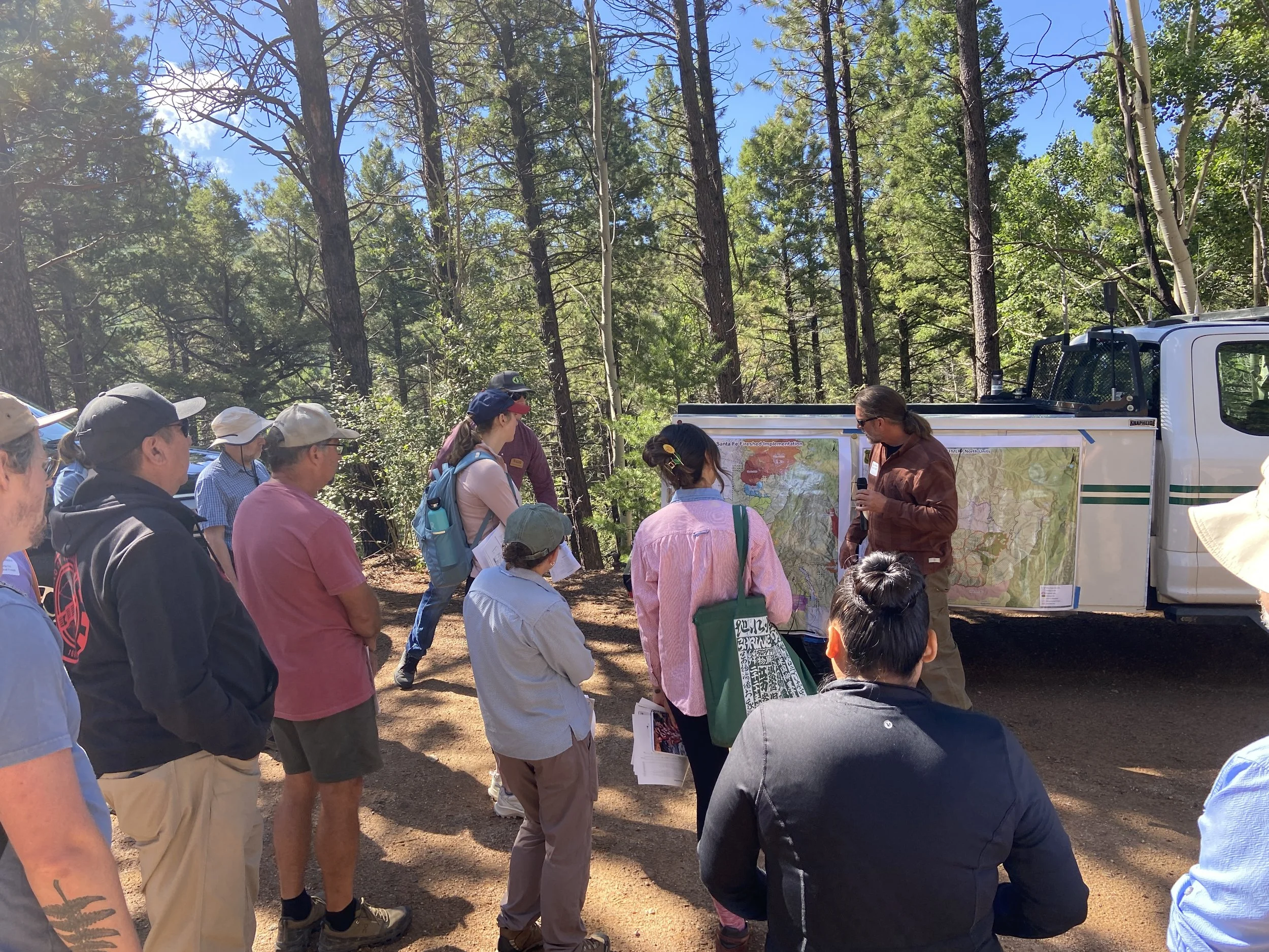
In early August 2025, the Greater Santa Fe Fireshed Coalition held its summer-season quarterly meeting as a field tour in the forests northeast of Santa Fe.
The goals of this tour were to (1) observe local projects to improve landscape resilience to high-severity wildfire and (2) discuss priorities for continued landscape-scale restoration work into the future. Attendees from a diverse range of organizations and affiliations generated interesting discussion, including goals and adaptations for where the Coalition is headed. Scroll down to read about five highlights of the field tour, including:
Additionally, the City of Santa Fe produced a long-form video of the field tour; please check it out if you are interested in taking a virtual visit!
— Maya
Field Tour Stop #1
The field tour’s first stop was the pullout about 1 mile down Forest Road 102 (roughly 1/3 mile west of Big Tesuque Campground).
Takeaways from decades of fire ecology research in the Greater Santa Fe Fireshed

Local U.S.G.S. research ecologist Ellis Margolis, Ph.D., explained that researchers have spent decades collecting samples of tree ring fire scars in the Greater Santa Fe Fireshed. (Fire scars in tree rings show when a fire burned and scarred a tree, and then the tree healed over the wound and “lived to tell about it.”)
Researchers have 36 plots across the Fireshed, from the Rio en Medio area into the Santa Fe Municipal Watershed and south to La Cueva. They’ve dated fire scars from over 300 sampled trees, with over 1,400 individual tree ring fire scars dated. The oldest tree ring records going back into the 1300s and the last recorded fire was in 1880, Margolis said.
“The ubiquitous story is fires didn’t used to kill trees; now they’re killing everything,” he said.
“We have one (sampled) tree that survived and recorded 18 fires over its life. I mean, how many trees in the modern fires are surviving any, if not multiple (fires)? It starts to paint this picture of: There used to be fire all the time… but it was not killing the majority of the trees.”
By stitching together networks of samples, researchers have also been able to study the size of historical fires. Two fires in 1685 and 1748, for example, burned almost every tree researchers sampled, indicating their area burned reached over 35,000 acres.
The takeaway: “Fire used to be really ubiquitous,” Margolis said, “but much lower severity.”
What changed? The Forest Service began aggressively suppressing all wildland fires in the early 1900s. And most of the fires in the Santa Fe Fireshed had actually stopped before then – in the late 1800s – due to overgrazing.

A dense stand at field tour Stop #1. Tree ring fire scars show that historically, fires occurred on average about every 14 years, Dr. Margolis said.
“If you do the quick math, we owe this forest 10 fires. And that’s why you get that,” he said, pointing to the dense mixed conifer.
The railroad arrived in Lamy, New Mexico in 1879, leading to an immediate and exponential expansion the grazing industry, and the last widespread fire the Santa Fe Fireshed was in 1880, Margolis said.
“This also gives you a little bit of a clue about what those fires were. If cows could have put out the fires, they weren't big, raging infernos where you drop in DC-10 slurry drops on them. They were little surface fires burning through grass. Then, the cows ate all the grass, and you couldn’t burn it anymore,” he said.
Now we have “145 years worth of fuel build up, 145 years of tree regeneration, and this is the problem that we hand over to our forest managers,” Margolis said.
Projects to age trees from tree rings indicate much lower tree densities in 1880 than today. Data from other monitoring projects in the Fireshed shows average current tree densities of around 700 trees per acre. That’s probably five times as many trees per acre today than historically, upwards of 10 times as many trees per acre, Margolis said.
The good news is we now “understand how we got here and where we need to go back to. These forests were much more resilient when fire was burning through them historically, so this sets the table for some of the management,” he continued.
“This forest WILL burn again, and hopefully we can get it back to a state of surviving these fires.”

Dr. Margolis shared data from researchers’ sampling plot nearest to the field tour stop. Horizontal lines show the records of individual trees sampled for tree ring fire scars. Vertical tick marks are the fire scars. Note that the most recent fire was in 1880, nearly 150 years ago.
Forest treatments underway in the Santa Fe Mountains
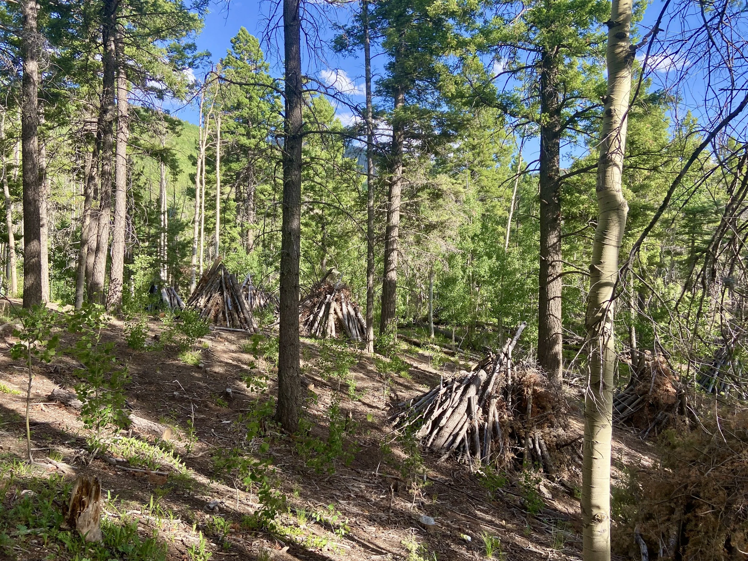
Piles of trees thinned as part of the Santa Fe Mountains Landscape Resiliency Project. The piles will be burned under snow during the winter.
At the field tour’s first stop, the Coalition observed thinned forest with unburnt piles south of Forest Road 102. The Forest Service had thinned and created the piles in the spring 2025 and will burn the piles while under snow during this upcoming winter (given the right snowy conditions) as part of the Santa Fe Mountains Landscape Resiliency Project.
Rian Ream, the Assistant Fire Management Officer for Española Ranger District and former fuels planner on the Santa Fe National Forest, explained the design of the treatments the group observed along Tesuque Creek: Santa Fe National Forest managers chose to focus on mixed-conifer forest in Tesuque Canyon partly because of the opportunity to anchor off of two already thinned and burned areas—Pacheco Canyon and the Santa Fe Municipal Watershed. Crews thinned fuel breaks along four treatment units in Tesuque Canyon by cutting conifers under 9’’ diameter (except white pine and aspen, which were not cut) and built piles of the downed material. Once those piles have been burned under snow, crews will dig hand lines along containment lines before the units will be ready for broadcast burning.

“The main thing we’re dealing with here is the fire problem,” Ream said, adding that a high-severity fire would be detrimental to wildlife habitat and watershed function. “This is going to burn, it’s just a matter of when.”
The challenge with prescribed fire is “it’s really getting harder and harder to find a good window to burn within,” particularly given stricter prescription parameters Santa Fe National Forest has written into burn plans since escaped prescribed fires grew into the destructive 2022 Hermit’s Peak/Calf Canyon Fire.

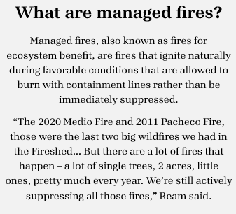
Managed fires would make a bigger impact for landscape resiliency (plus could be easier to implement, since firefighting resources come from across the country for a managed fire but not for a prescribed fire), but some vocal public opposition has meant “we’re just not there in the Santa Fe Fireshed yet to do that,” Ream said.
The good news is that about two decades of work thinning and prescribed burning the Santa Fe Municipal Watershed has put the watershed in “a much healthier situation,” said Eytan Krasilovsky, Deputy Director of the Forest Stewards Guild.
But one of the impetuses for the formation of the Greater Santa Fe Firehsed Coalition in 2016 was the recognition of the need to work north and south of the municipal watershed, he added. “All these watersheds need work, and if we can avoid some of the catastrophes that we're seeing around the country and in New Mexico, then it's all going to be worth it.”
Field Tour Stop #2
For the second stop on the field tour, we parked at Aspen Ranch Trailhead and walked northwest along a 2019 prescribed burn implemented through the Pacheco Canyon project.
Outcomes of past forest treatments in Pacheco Canyon
In 2016, the Reserve Treaty Rights Lands program rolled out, and the Pueblo of Tesuque collaborated with the Forest Service over the following years to plan and execute an over 2,000- acre forest treatment in Pacheco Canyon, said Pueblo of Tesuque Department of Environment and Natural Resources (DENR) Environmental Biologist Ryan Swazo-Hinds.
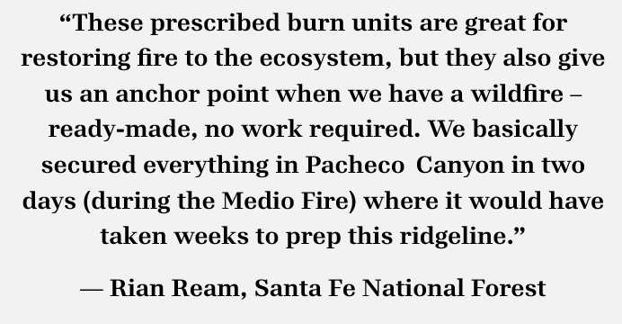
Prescribed fire cleaned up the understory as intended, but the biggest success of the project was enabling firefighters to contain the 2020 Medio Fire – a fire ignited by lightning, Ream said.
Ream, who responded to the fire, said the Medio Fire was on the move and “would have burned all the way up to the ski area and possibly into the Santa Fe watershed,” but “luckily, we had this prescribed burn unit.”
“Even though that thing had a head of steam, when it hit that fuel break where it had been thinned out, it changed to a lower severity,” he said.
Post-fire flood impacts in the Greater Santa Fe Fireshed
The Medio Fire, which burned roughly 4,000 acres, still had significant post-fire flood impacts, said Steve Vrooman, president of Keystone Restoration Ecology, which implemented a post-fire watershed stabilization project on the Rio en Medio following the Medio Fire.
A few years following the fire, the Rio en Medio flooded when a rainstorm dumped 3 ¼ inches in an hour and caused a cascading debris dam down the drainage, Vroom said. “Above that, this watershed is in pretty good condition. I mean, it got affected, but the ponderosas are still there, it still looks like the same stream; below that, it doesn't,” he said.
“Frankly one of the biggest impacts (of fire) is the flooding, as we’ve see in Ruidoso and Bandelier,” Vrooman continued. “The loss of trees is huge, impacts to wildlife are huge, but the post-fire flooding impacts are probably the biggest one. Things that can happen are you can lose most of your sediments in the watershed, you can lose the function of your streams, and you can actually lose the ability for that stream to support fish, to provide water to irrigators, and to even feed the watershed.”
“There’s generally a bifurcation between watershed restoration and fire. We don’t always talk together, and we need to be,” he continued. “The watershed impacts from fire can be extreme, and those are impacts that happen if we don't do what’s been talked about today… We thin to prevent flooding.”
Alan Hook, City of Santa Fe Water Division Water Resources Coordinator, added that post-fire flooding threats to the Santa Fe Municipal Watershed are still daunting, although forest treatments in the watershed have reduced that risk, a 2024 study showed.
The study concluded that a moderate- to high-severity wildfire in the watershed followed by a heavy rain event would fill part or most of the city reservoir with sediment, Hook said.
“That's a big risk for us as water utility – a big, big risk,” he said. “That means we’ve got to rely on San Juan-Chama Project water, which is coming from Colorado, and then secondarily, much of our supply would have to be pumped out of the groundwater near the Rio Grande in our city well field for a very long time… I mean, hate to break the news: We’re really not prepared for that.”
Information from the study may help the city create an emergency action plan for post-fire flooding in the watershed, Hook said.
The city does have funding capacity to support further forest treatments, he added, noting the city is spending roughly $50 million to upgrade Nichols and McClure dams – “it’s just a matter of convincing engineers and managers to invest in the green infrastructure instead of what's called gray infrastructure (pipes, dams, reservoirs, pumps). So that's kind of where we need the impetus of the public, because we are a community-owned utility,” he said.
Field Tour Stop #3
For the field tour’s final stop, the Coalition gathered at on the Pueblo of Tesuque’s lands at Aspen Ranch (which are not open to the public without tribal permission).
The Pueblo of Tesuque's stewardship of ancestral lands
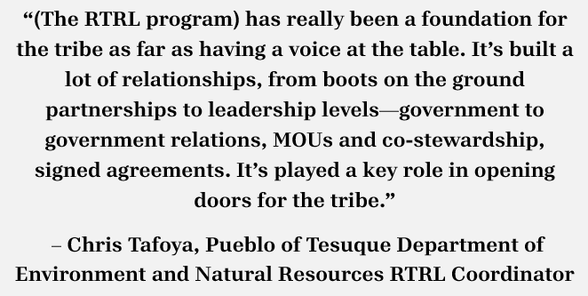
In the early 2010s, the Pueblo of Tesuque and Santa Fe National Forest signed a Memorandum of Understanding, which later enabled a collaborative, cross-boundary prescribed burn — on Forest Service land and the Pueblo of Tesuque’s Vigil Grant — during the Pacheco Canyon project.
“Having those prior relationships, we’re able to work (with the Forest Service) on other stuff such as water quality and erosion control,” said Joseph Abeyta, the Pueblo of Tesuque DENR Interim Director and Water Quality Specialist. “So Tesuque is evolving with these relationships with multiple agencies, … and it’s a good opportunity for us because everything overlaps: water quality, forestry, wildfire, wildlife.”
The Pueblo has a cold-water fisheries designation for the Rio en Medio at Aspen Ranch and is looking to reintroduce native Rio Grande cutthroat trout as well as potentially beavers, Abeyta and Swazo-Hinds said.
One challenge at Aspen Ranch has been that, though the forest has long been thinned and piled, the Pueblo hasn’t yet received support from the Bureau of Indian Affairs to burn the piles. The Santa Fe National Forest can boss the pile burn but does not have capacity to monitor until the burn is out, which is where capacity from BIA or outside partners will hopefully come in, Swazo-Hinds said.

A field tour stop where the 2020 Medio Fire reached the area of a 2019 prescribed burn in Pacheco Canyon.
Coalition partner organizations present for the field tour included the Santa Fe National Forest, U.S. Geological Survey, Pueblo of Tesuque, City of Santa Fe Water Division, City of Santa Fe Fire Department, Santa Fe Watershed Association, Santa Fe Conservation Trust, Forest Stewards Guild, New Mexico Forest and Watershed Restoration Institute, and Santa Fe-Pojoaque Soil and Water Conservation District, along with additional contacts and VIPs.