Wildfire Wednesdays #91: The Home Ignition Zone

Hi Fireshed Coalition Members and Partners,

With all the devastation and grief of the 2022 wildfire season, it is normal to feel overwhelmed and debilitated when thinking about wildfire risk. We recognize the real frustration and danger that many are feeling related to the consequences of public land management. In light of all of this, we need to keep making incremental progress toward wildfire risk reduction by taking action on our properties and talking to those in our communities about wildfire. Our options are to do the work ourselves by following defensible space and home hardening principles or to work with contractors in our area to reduce wildfire risk on our properties.

This blogpost will share some resources to support you, your loved ones, and those in your communities/neighborhoods in your efforts to reduce wildfire risk on your property. Read on for:

  • The Home Ignition Zone

  • Home hazard assessments

  • International WUI codes

  • Community Wildfire Defense Grants - new funding opportunity

Stay safe,

Gabe

The Home Ignition Zone - Residents

The Home Ignition Zone encompasses the concepts of home hardening and defensible space. Home hardening involves the materials that you build with and the receptivity of your structure to ignition from flames, embers, and radiant heat. Defensible space is the buffer that you create between your home and the vegetation that surrounds it. By working on these two components, we can make a meaningful reduction in the risk of home loss from wildfire. Remember, up to 90% of ignitions from wildfires are caused by embers blown by the wind, so be sure to think of where embers may collect and start your home/property on fire.

Proper defensible space provides firefighters with a place to defend your home. We encourage homeowners to take the concept one step further and plan to have your home survive wildfire even if there are not firefighter stationed around it — this is type of planning could be called survivable space. The following information about defensible space is courtesy of the National Fire Protection Association.

Immediate Zone

“The home and the area 0-5’ from the furthest attached exterior point of the home; defined as a non-combustible area.  Science tells us this is the most important zone to take immediate action on as it is the most vulnerable to embers. START WITH THE HOUSE ITSELF then move into the landscaping section of the Immediate Zone.

  • Clean roofs and gutters of dead leaves, debris and pine needles that could catch embers.

  • Replace or repair any loose or missing shingles or roof tiles to prevent ember penetration.

  • Reduce embers that could pass through vents in the eaves by installing 1/8 inch metal mesh screening.

  • Clean debris from exterior attic vents and install 1/8 inch metal mesh screening to reduce embers.

  • Repair or replace damaged or loose window screens and any broken windows Screen or box-in areas below patios and decks with wire mesh to prevent debris and combustible materials from accumulating.

  • Move any flammable material away from wall exteriors – mulch, flammable plants, leaves and needles, firewood piles – anything that can burn. Remove anything stored underneath decks or porches.”

Intermediate zone

5-30’ from the furthest exterior point of the home. Landscaping/hardscaping- employing careful landscaping or creating breaks that can help influence and decrease fire behavior

  • Clear vegetation from under large stationary propane tanks.

  • Create fuel breaks with driveways, walkways/paths, patios, and decks.

  • Keep lawns and native grasses mowed to a height of four inches.

  • Remove ladder fuels (vegetation under trees) so a surface fire cannot reach the crowns. Prune trees up to six to ten feet from the ground; for shorter trees do not exceed 1/3 of the overall tree height.

  • Space trees to have a minimum of eighteen feet between crowns with the distance increasing with the percentage of slope.

  • Tree placement should be planned to ensure the mature canopy is no closer than ten feet to the edge of the structure.

  • Tree and shrubs in this zone should be limited to small clusters of a few each to break up the continuity of the vegetation across the landscape.

Extended zone

30-100 feet, out to 200 feet. Landscaping – the goal here is not to eliminate fire but to interrupt fire’s path and keep flames smaller and on the ground.

  • Dispose of heavy accumulations of ground litter/debris.

  • Remove dead plant and tree material.

  • Remove small conifers growing between mature trees.

  • Remove vegetation adjacent to storage sheds or other outbuildings within this area.

  • Trees 30 to 60 feet from the home should have at least 12 feet between canopy tops.*

  • Trees 60 to 100 feet from the home should have at least 6 feet between the canopy tops.*

Home Hazard Assessment - Fire Departments

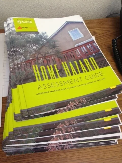
There are many programs for home hazard assessments. A good place to start is to reach out to your local fire department, a local soil and water conservation district, or a wildfire risk reduction organization to see if they offer a home hazard assessment walk-through to help you better understand how to reduce your wildfire risk. This type of program may not exist in your area. To support people that may not have access to a walk through, the Guild created a Home Hazard Assessment Guide.

This guide provides homeowners with tools to assess your home's wildfire risk and prioritizes actions you can take to reduce that risk. The assessment worksheet included with this guide is intended to help you understand your risk and where vulnerabilities on your property may lie. Every home is different in terms of wildfire risk and hazards. The goal for this worksheet is not to get a hazard rating of zero, but simply to address certain vulnerabilities that present a wildfire risk to your home. Where you choose to reduce risk on your property is specific to your property's unique features. Start by inquiring with your local fire department about wildfire risk in your area. Your community may have a Community Wildfire Protection Plan (CWPP) which will provide you with a CWPP ranking and recommendations for reducing risk in your community.

Use the Home Hazard Assessment Guide and the Home Hazard Assessment Worksheet (to be used with guide) to analyze your risks and develop a plan for action.

Developed in partnership between the Wildfire Network and the Forest Stewards Guild

Wildland Urban Interface Codes

In New Mexico, many communities have existing adjacent to forested areas for centuries. In newer areas, population growth and expanding urban development have increased the contact between humans and wildfire.

For those that work in county or municipal governments, or those that would like to advocate for more wildfire adapted development in your area, the International Wildland-Urban Interface Code (IWUIC) is a good place to start. The IWUIC is referenced in many community wildfire protection plans (CWPPs) across New Mexico.

The IWUIC is a model code that is intended to be adopted and used supplemental to the building and fire codes of a jurisdiction (e.g. county, or municipal government). The unrestricted development of property in the WUI is a potential threat to life and property from wildfire and resulting erosion. The objective of the IWUIC is to establish minimum special regulations to safeguard life and property from intrusion of wildland fire into communities.

Community Wildfire Defense Grants

Stakeholders in Colfax County discuss wildfire risk and treatment priorities

As you may know, on July 26, 2022, Agriculture Secretary Tom Vilsack formally announced the new $1 billion Community Wildfire Defense Grant (CWDG) program. This new, five-year, competitive program funded by President Biden’s historic Bipartisan Infrastructure Law is designed to assist at-risk communities, including Tribal communities, non-profit organizations, state forestry agencies and Alaska Native corporations with planning for and mitigating wildfire risks.

There will be a series of webinars August 4th, 8th and 9th to provide potential applicants with an overview of the grant program.

The registration links for the applicant webinars just went live earlier today, so folks may now register.  The dates/times below are the ones that have been posted on the CWDG website. Here is the link to register, and the attached document should walk you through the registration process:

Community Wildfire Defense Grant Program Applicant Webinars

Upcoming Webinars for Applicants

  • Northeast-Midwest States: August 4, 2022 at 10:00 a.m. (Eastern Time)

  • Western States and Territories: August 8, 2022, at 2:00 p.m. (Eastern Time)

  • Southern States: August 9, 2022, at 10:00 a.m. (Eastern Time)

  • Tribes: August 9, 2022, at 2:00 p.m. (Eastern Time)

For instructions on how to register for these webinars, click here.

Wildfire Recovery Event July 23 and 24 - Las Vegas, NM

Celebrate community resilience this weekend!

Residents impacted by the Hermit’s Peak/Calf Canyon wildfires and flooding are invited to Rise, Register, and Recover in Las Vegas, NM this Saturday and Sunday.

On Saturday, July 23, from 2:00-8:00pm, enjoy a concert and wildfire relief benefit raffle in the Plaza Park.

On Sunday, July 24, from 1:00-4:00pm, meet at Memorial Middle School for a resource fair and supply distribution focused on sharing information with the community and helping everyone move forward with long-term recovery.

This event is free and open to the public.

Please help share the word!

Wildfire Wednesday #90: Community Forestry

Following a devastating start to the 2022 fire season, New Mexico residents are facing the challenging reality of wildfire recovery. A Hermit’s Peak/Calf Canyon flood warning map is available from Highlands University. Those affected by recent and ongoing fires can learn more by visiting the After Wildfire (afterwildfirenm.org) website. Mental health resources are also available from our last Wildfire Wednesdays post. Finally, refer to the bottom of this blog post for land restoration workshop opportunities happening now for landowners impacted by the Hermit’s Peak/Calf Canyon Fire.


Hello Coalition members and partners,

We hope you’re staying cool as the hot summer days fly by. This week we will be introducing an often-overlooked niche of land management: community forestry. This concept involves local communities as active participants in the stewardship of surrounding forested lands. It also helps build capacity to meet multiple objectives - reducing fire risk, improving forest health and habitat, and maintaining cultural and community vitality.

This week features information on:

  • Existing community forestry programs in the West

  • Forest Council initiatives in New Mexico

  • Opportunities to learn more about community forestry, other community-led initiatives, and funding for community forests

  • Past examples of how communities have come together for post-fire response and recovery

Take care and have a wonderful Wednesday,

Rachel


Existing Community Forestry Programs

How can we learn from the paths that others have already forged?

The exact configuration of community forestry initiatives - the land jurisdiction, leadership, and their objectives - can vary widely. Here are a few highlights from those who have led by example.

Mt. Adams Community Forest: A new model of forest ownership for the West

A checkerboard satellite map with land ownership boundaries overlaid

Land ownership in the vicinity of Mt. Adams Community Forest: image courtesy of Mt. Adams Resource Stewards

Established in 2011, Mt. Adams Community Forest is the State of Washington’s first nonprofit-owned working community forest. The project began with an opportunity and subsequent fundraising to purchase the 100-acre Glenwood Valley’s Mill Pond property with its productive forests, restoration opportunities, water, and recreation resources. A few years later, community members and friends of Mt. Adams Resource Stewards (MARS) rallied again to purchase an adjacent 285-acre block in the form of Pine Flats Forest, followed by additional acquisitions in 2020. While the group is looking continually looking for opportunities to grow the forest through future land acquisitions, their focus is on growing a locally meaningful model of conservation and stewardship.

In their words, “the Mt. Adams Community Forest strives to permanently protect high community- and conservation-value forests critical to the quality of life of [south-central Washington]. Management goals for community forest properties are centered around principles of land stewardship, community benefit, and healthy functioning ecosystems. Such goals recognize the value of sustainably managed forest resources as a renewable source of wood products and jobs, balanced with the provision of habitat for flora and fauna, and public access for recreation. Tradition is an important element of the Mt. Adams Community Forest vision, and activities such as fishing, hunting, and firewood gathering are provided for when possible.”

Flowering bushes of purple and yellow color the understory of a pine forest with scattered woody debris and oak trees

Pine Flats Tract: image courtesy of Mt. Adams Resource Stewards

While management of the forest is carried out by the nonprofit landowners, Mt. Adams Resource Stewards, community members provide guidance on management priorities through public listening sessions and direct recommendations from their community advisory committee.

Learn more about Mt. Adams Community Forest

Western Klamath Restoration Partnership

“The Western Klamath Restoration Partnership (WKRP) began in 2007, focusing on in-stream fish habitat restoration of the Middle Klamath River sub-basin. It became a 1.2-million-acre upslope restoration collaborative incorporating an “all lands” approach to address threats to people, property, cultural and natural resources at risk of high-intensity wildfire.” It has since grown in scope and size to include more partners, entire landscapes, and new objectives, but stays true to its original intent: to build trust and a shared vision for restoring fire resilience at the landscape scale.

A map showing the WKRP's geographic area, land ownership, and project plans.

Geographic scope and planning area of the Western Klamath Restoration Partnership. Image courtesy of WKRP.

The WKRP is a unique project which began as a community-stewardship initiative and has expanded into a multidimensional collaborative of diverse stakeholders. Their trajectory offers many lessons learned, such as finding common ground through identification of Zones of Agreement (geographic areas where all parties agree upslope restoration needs to occur). Through honest dialogue using Open Standards Process for Conservation, they have been able to create a plan for restoring fire resilience at the landscape scale which is founded upon Traditional Ecological Knowledge (TEK) and practices and concepts outlined in the National Cohesive Wildland Fire Management Strategy.

Flowchart showing conservation measures partnership open standards: 1 conceptualize, 2 plan actions and monitoring, 3 implement actions and monitoring, 4 analyze, use, and adapt, and 5 capture and share learning

Visualization of the Open Standards Process for Conservation. Image courtesy of the Western Klamath Restoration Partnership

A hallmark of the partnership “is the Karuk Tribe’s knowledge of fire, passed down from generation to generation. This ‘traditional ecological knowledge’ (TEK) shows us that traditional human/fire relationships of our past can guide the strategies of our future. Representatives from the Karuk Tribe, Mid Klamath Watershed Council, Salmon River Restoration Council, and the US Forest Service are co-leads of the collaborative group, but many other stakeholders, communities and organizations are involved.”

LEARN MORE ABOUT WESTERN KLAMATH RESTORATION PARTNERSHIP

New Mexico Forest Councils

Forest Councils lay the groundwork for local residents to actively steward forested lands as a way to protect water, property and their way of life. While the Councils represent a broad and customizable organization structure, they consistently fill the role of providing governance and leadership for community-forestry efforts.

Cerro Negro Forest Council

A nonprofit entity led by representatives from five local organizations, “the Cerro Negro Forest Council represents residents of Valdez, San Cristobal and Gallina Canyon in their efforts to improve forest health and prevent devastating wildfires in parts of Taos County, New Mexico… The council has adopted the principles of acequia water management and are applying those principles to community-led forestry as a way for locals to generate an income from wood products while improving the health of their forests and watersheds.” Established in 2018, the Forest Council structure is modeled after a community-based forest stewardship program which ran for many years out of the U.S. Forest Service - Camino Real Ranger District.

Cerro Negro puts this model of community-led stewardship into action through implementation of their Forest Mayordomo Collaborative Forest Restoration Program project. Local woodcutters, or leñeros, are assigned and made responsible for thinning of small forested blocks on federal land. In return they receive a per-acre work stipend and can harvest all woody material they cut. This work is carried out under the supervision of the Forest Council’s mayordomo and asistante to ensure that treatments comply with the rules and regulations of the U.S. Forest Service.

Rio de Las Trampas Forest Council

Modeled after the successful Cerro Negro Forest Council and brought back home to the Camino Real Ranger District, Rio de Las Trampas Forest Council’s mission is “to foster collaboration and community involvement in forest and watershed health projects through the implementation and administration of stewardship agreements.” Their work is driven by the understanding that climate change, intense wildfires, unnaturally dense forests, and drought threaten the lands that support their communities.

A multi-generational family poses atop a pile of firewood

A wood pile in El Valle gathered through the original USFS community forestry program which led to the creation of the Forest Councils. Photo by Kay Mathews.

The Council knows that “it is possible and replicable to partner with federal land managers to accomplish thinning objectives and reduce wildfire risk while providing a maximum benefit to local residents” and puts this knowledge into practice through their 2019 CFRP Supporting the Rio de Las Trampas Forest Council’s Leñero Program. This project replicates Cerro Negro’s Forest Mayordomo CFRP by training, educating, and paying local leñeros to thin and treat acres of federal land. In the end, this project aims to “provide fuelwood to the community, achieve forest thinning goals, and offer local residents the opportunity to care for the land”.

Read more about the Rio de Las Trampas Forest Council’s mission and model of community forestry.


Learning Opportunities

Deep-dive into the world of community forestry!

An up-close view of a small-diameter aspen log deck

Photo by Scott Ishimara, copyright.

Empowering Community-led Forest Stewardship webinar on July 28, led by The Nature Conservancy, New Mexico. Healthy forests and wood products are essential to sustaining our communities and traditional use practices in New Mexico, but access to forests has been inhibited by multiple barriers. To address those challenges and discuss opportunities, The Nature Conservancy is hosting a free virtual event, generously supported by the Taos Ski Valley Foundation.

Register Now!

Get funded through the USDA’s Community Forest Program

“The Community Forest Program (CFP) is a competitive grant program that provides financial assistance to tribal entities, local governments, and qualified conservation non-profit organizations to acquire and establish community forests that provide community benefits. Community benefits include economic benefits through active forest management, clean water, wildlife habitat, educational opportunities, and public access for recreation.”

This program funds establishment of private forest lands for community use which meet certain qualifications. Mt. Adams Community Forest, the program highlighted in the first section of this newsletter, is funded in part by the CFP!

MORE ABOUT THE COMMUNITY FOREST PROGRAM

Learn about the community’s role in stewarding our urban forests

The New Mexico Energy, Minerals, and Natural Resources Department runs and Urban and Community Forestry Program to help communities develop and sustain healthy urban forests.

A planted seedling in the foreground against the backdrop of the shovel used to plant it

Image courtesy of NM EMNRD

They expand the definition of community forests to include all trees, vegetation, and associated natural resources within and around an inhabited area. Community trees include park trees, trees along streets and neighborhoods, and any trees within the wildland-urban interface between communities and adjacent forestlands.

The services offered by the Urban and Community Forestry are borne of the understanding that urban forests deliver tremendous value to communities and the people that live there. Trees contribute to reduced storm water runoff, improved air and water quality, increased property values, improved quality of life for citizens, increased economic development opportunities, and reduced energy use at homes and businesses.

VISIT EMNRD'S URBAN AND COMMUNITY FORESTRY PROGRAM WEBPAGE

Post-fire Community Response and Recovery

How can the community come together following a wildfire?

As a community, the other side of fire preparedness is how we come back together to respond to, recover from, and maintain our culture and traditions following a fire.

Learn about one Tribe's collaborative journey to develop forest resiliency and how Santa Clara Pueblo Forestry has been able to incorporate lessons learned from past wildfires into new Fire and Forest Management Plans to keep fire an active component in maintaining the landscape.

One takeaway from Santa Clara Pueblo’s experiences is that adapting to wildfire needs to happen both before and after the fire. Lindsey Quam and Gabe Kohler took that to heart and offer low-cost strategies for flooding and erosion mitigation is this 2019 FACNM article. These methods were part of a landscape-scale effort to mitigate flooding and erosion after the 2011 Los Conchas fire but are powerful tools for response and recovery that can be used to leverage the people-power in any community and make an impact against flooding and erosion before it occurs.

For landowners impacted by the Hermit’s Peak/Calf Canyon Fire, Luna Community College and the Forest and Watershed Restoration Institute (FWRI) are offering a free workshop series on land restoration techniques, happening now. The workshops will cover:

  • Reading the landscape and assessing post-fire damage, risks, and hazards

  • How to use burn severity maps to assess your land’s vulnerability to flooding

  • Post-fire forest thinning

  • Adapting road and culverts for post-fire flood mitigation

  • Erosion control with log structures, wattles, mulch and soil amendments

  • One-rock dams and arroyo restoration

  • Trash and debris racks

  • Contour felling and upland restoration for erosion prevention

  • Seed mixes and tree/shrub planting

  • Basic principles in monitoring the effects of post-fire restoration

July 23-24 (Saturday-Sunday): erosion control community service project in San Ignacio with the Albuquerque Wildlife Federation.

July 25-28 (Mon-Tues, Wed-Thurs): contour felling (2 days in Las Dispensas, San Geronimo), seeding (1 day in San Geronimo), and possibly discussing biochar (1 day)

August 4-7 (Thurs-Fri, Sat-Sun): post-fire forest thinning (two 2-day workshops)

You may sign up at luna.edu or show up at the designated meeting areas on the day of the workshops. For assistance, contact Karen Wezwick at 505-454-5308 or via e-mail at kwezwick@luna.edu.

Smoke from a wildfire billows above forested hills, obscuring mountains in the background

Image courtesy of AfterWildfireNM.org

Wildfire Wednesdays #89: Weather Monitoring and Modeling

Following a devastating start to the 2022 fire season, New Mexico residents are facing the challenging reality of wildfire recovery. A Hermit’s Peak/Calf Canyon flood warning map is available from Highlands University. Those affected by recent and ongoing fires can learn more by visiting the After Wildfire (afterwildfirenm.org) website. Mental health resources are also available from our last Wildfire Wednesdays post. Finally, keep an eye out on the FACNM website for information about an upcoming post-fire community resources expo in Northern NM.

Take care and stay safe.


Happy Wednesday, FACNM Community!

As the climate changes, gathering precise and local weather data can help us understand how it is impacting the arid Southwest in real time. Weather monitoring station data, from community science efforts to a permanent technical network across the county, can inform weather predictions and future climate trends.

Today’s Wildfire Wednesday features:

  • Weather station basics - what are they and why do they matter?

  • How the data is used and how you can help

  • Upcoming events

Best wishes,

Rachel


Weather station basics

What are weather stations and why do we need them?

Together with satellites, weather buoys, meteorological probes, and radars, weather stations, or meteorological stations, are primary facilities for weather observation and collection of different weather data. These facilities contain instruments and equipment for measuring atmospheric conditions such as temperature, atmospheric pressure, humidity, wind speed, wind direction, and precipitation amounts. Weather stations measure conditions at a single geographic location and send these data to processing or collection centers. Together, atmospheric measurement data from a network of weather stations inform our weather forecasts and allow us to study the weather and climate. Most weather stations today are automated and may transmit data daily or hourly.

Types of weather stations

Professional vs Home or Amateur Weather Stations

NASA Dryden meteorologists prepare to launch a weather balloon next to a Sonic Detection And Ranging wind profiling unit. Photo: NASA Dryden / Tom Tshida

Professional, or synoptic, weather stations must meet international meteorological standards and pass the accuracy requirements of the National Institute of Standards and Technology. These facilities collect the most complete meteorological data and are often part of the World Meteorological Organization station network.

Amateur weather stations collect the same basic weather data - air temperature, wind speed and wind chill, humidity, atmospheric pressure, and more - but in general the data are less complete compared to professional weather stations. Many amateur stations contribute to global weather station networks and their data can be exchanged online through cooperative databases such as MesoWest. The Citizen Weather Observer Program (CWOP) also facilitates the sharing of information from personal weather stations. These data are utilized by groups such as the National Weather Service (NWS) and Weather Underground when generating forecast models.

Learn more about the differences here.

Remote Automatic Weather Stations (RAWS)

Data from a RAWS station installed in the Zuni Mountains of western NM is transmitted to MesoWest.

RAWS are self-contained portable or permanent solar-powered weather stations that provide timely local weather data. According to the National Interagency Fire Center, “there are nearly 2,200 interagency RAWS strategically located throughout the United States. These stations monitor the weather and provide weather data [used for] projects such as monitoring air quality, rating fire danger, and providing information for research applications… RAWS units collect, store, and forward data to a computer system at the National Interagency Fire Center (NIFC) in Boise, Idaho, via the Geostationary Operational Environmental Satellite (GOES), operated by the National Oceanic and Atmospheric Administration (NOAA).”

NOAA and the National Science Foundation (NSF) also support other group-source and citizen science weather data collection initiatives such as the Community Collaborative Rain, Hail and Snow (CoCoRaHS). Learn more about this network below in How to get involved.


How weather stations influence science and safety

Improved weather forecasting for improved fire outcomes

NOAA and the NWS provide daily weather forecasts through their Weather Prediction Center.

According to the National Weather Service, “[Professional] forecasters build their forecasts with observations from surface stations, weather balloon readings, and satellite data that feed numerical weather, water, and climate models whose output is analyzed and scrutinized using individual scientific expertise. Forecasters communicate this information and potential impacts to the public, emergency managers, and other core partners to help make decisions that save lives and protect property.” Weather monitoring data may also feed into automated weather forecasts which are used by fire personnel, land managers, and others involved in prescribed and wildland fire to better understand the conditions on the ground. “Fire managers use weather station data to predict fire behavior and monitor fuels; resource managers use the data to monitor environmental conditions” (NIFC).

When writing a burn plan, fire managers pull data from multiple RAWS stations to estimate 99% weather conditions for the site. This means that actual weather conditions will vary from the predicted model less than 1% of the hours in a year. Fire managers base their fire behavior models and burn parameters, in part, on these anticipated weather conditions. Having accurate local weather is also imperative for tracking localized trends and changes in weather conditions. For this reason, fire managers may utilize a mobile weather monitoring station or order a spot forecast from the NWS to gather meteorological data at the exact location of their prescribed burn or wildfire.

Learn more about the science and art of fire weather and how it is used to predict fire behavior.

Evaluating the impact of climate change

Modeled temperature change under future climate scenarios from the U.S. Global Change Research Program’s National Climate Assessment.

“To make weather forecast predictions, meteorologists use weather data and forecast models to determine current and future atmospheric conditions. Because weather takes place hour by hour, forecast models use current atmospheric and oceanic conditions to predict future weather” (from Columbia Climate School). “Climate models are [essentially] an extension of weather forecasting… but [instead of making] predictions over specific areas and short timespans, climate models are broader and analyze long timespans. They predict how average conditions will change in a region over the coming decades.” Nuanced and accurate weather data informs our understanding of current conditions and also allows us a greater understanding of how weather conditions are changing over time, both in the datasets and when compared to historical ranges. With real-time localized data, weather monitoring stations allow us to analyze trends in precipitation, temperature, and other climatic conditions which play a role in evaluating the impact of climate change.

How to get involved

Image courtesy of Iowa State University

Interested in becoming a citizen scientist and helping to track local weather trends? A recent environment story by NM Political Report encouraged individuals to “participate in the Community Collaborative Rain, Hail and Snow Network, better known as CoCoRaHS. For a small fee to purchase equipment, which runs around $40, individuals can set up a weather station at their house that will provide valuable information to researchers.”

SIGN UP TO JOIN THE COCORAHS NETWORK

Upcoming events

Webinars

Wildfire Wednesdays #88: Post-Fire Recovery

Hi Fireshed Community,

Experiencing a destructive wildfire is devastating. Amidst all the grief and loss, navigating the process of recovery and rebuilding can feel debilitating. With all wildfire that we have already experienced in New Mexico this 2022 fire season, we want to support the recovery process by providing a list of mental health resources and funding programs.

As we begin to think about monsoon season, it is important for communities to plan for and mitigate the potential effects of flooding and erosion. There is a flash flood watch for the Las Vegas, NM area for today, June 8th.

Please reach out to any friends and family that may have been impacted by the 2022 NM wildfire season and consider sharing these resources with them. If you have not been personally affected by wildfire, and you would like to help out those in need, please skip ahead to the end to learn about donating your money to people in need.

Thank you,

Gabe

Mental and Emotional Support

Feelings such as overwhelming anxiety, constant worrying, trouble sleeping, and other depression-like symptoms are common responses before, during, and after wildfires. Other signs of emotional distress related to wildfires include:

  • Having thoughts, memories, or nightmares related to the wildfire that you can’t seem to get out of your head

  • Worrying a lot of the time; feeling guilty but not sure why

  • Excessive absences from work or school

These are just a few warning signs of disaster-related distress. Learn more about warning signs and risk factors for emotional distress related to wildfires and other disasters.

If you or someone you know is struggling with mental health following the recent wildfires, please take a look at the following resources that are available to support you through your process with grief and loss.

For those affected by the Hermit’s Peak/Calf Canyon wildfire

Mental health services for the New Mexico Highlands University community are available at the NMHU clinic 8 a.m. to 5 p.m., Monday through Friday. To make an appointment, call 505-454-3218.

Mental Health Counseling available for all in San Miguel and Mora counties Community-Based Services–NM Behavioral Health Institute after-hours crisis line: 505-425-1048

Calf Canyon-Hermit’s Peak Fire Emotional Support Group

If you would like support for you and/or your loved ones during this difficult time, join our support group. Many are struggling with not only stress but grief and loss time, you are not alone. Your feelings are valid and you deserve a safe space to share them.

Everyone is welcome!

Every Monday at 5 p.m.starting May 16, 2022

Memorial Middle School
Las Vegas, NM 87701

If you would prefer individual or family support, please call or text 505-587-9549 or 505-429-3511

Sponsored by  100% Community Behavioral Health Action Team

For those affected by the Calf Canyon/Hermit’s Peak wildfire or any other wildfire in the state:

Statewide NM crisis line: 1-855-NMCRISIS (855-662-7474)

Post-Fire Funding for Landowners and Acequias

NRCS Emergency Watershed Program

Landowners who were affected by the recent Hermits Peak and Calf Canyon wildfires in San Miguel and Mora counties can apply for the NRCS Emergency Watershed Program (EWP). The program will cover 90% of the cost of post-fire mitigation measures that can protect life and property. The local sponsor (SWCD) will cover the 10% match. The landowner can contribute in-kind materials and labor toward the 10% match. Examples of EWP mitigation measures include erosion control through contour felling, debris removal, retention ponds, berms, etc. For more examples, view the video recording from a recent meeting below.

Click here for the recording of a recent meeting by the Tierra y Montes SWCD: Meeting Recording

Individual landowners or acequias can apply. The links below are for each of the two SWCDs who are sponsoring the program at the local level by both the Tierra y Montes SWCD and Western Mora SWCD.

After you apply, the NRCS will contact you to conduct a site visit.

Post Fire Remediation through Hermit’s Peak Watershed Alliance

If you are not eligible to receive Emergency Watershed Protection Program funding, Hermit's Peak Watershed Alliance is also able to help with post-fire remediation work. We can bring technical expertise, materials and volunteer crews to projects such as seeding, erosion control and the slowing of potential flood waters. If you would like to schedule a site visit, please email us at hpwa@hermitspeakwatersheds.org.

Emergency Conservation Program

In addition to the NRCS EWP Program, there are other programs to assist producers during times of drought or wildfire. The FSA will soon announce a sign up period for the Emergency Conservation Program (ECP) to assist landowners with fire and flood related damages such as broken fences, ash and silt on lands, etc. Stay tuned for more updates.

Producers in Colfax County are eligible to apply for 2022 Livestock Forage Disaster Program (LFP) benefits on native pasture. LFP provides compensation if you suffer grazing losses for covered livestock due to drought on privately owned or cash leased land or fire on federally managed land. County committees can only accept LFP applications after notification is received by the National Office of qualifying drought or if a federal agency prohibits producers from grazing normal permitted livestock on federally managed lands due to qualifying fire. 

You must complete a CCC-853 and the required supporting documentation no later than January 30, 2023, for 2022 losses. For additional information about LFP, including eligible livestock and fire criteria, contact the Colfax County USDA Service Center at 575-445-9471 or visit fsa.usda.gov.

Potential applicants should be aware that they need to have farm records established at the Farm Service Agency (FSA) to be eligible to apply for the the above FSA programs. The NMAA can provide technical assistance with the sign up process. For more information, contact serafina@lasacequias.org.

Funding for Community Organizations Supporting Recovery

The Santa Fe Community Foundation is pleased to announce that they are now accepting applications for wildfire relief funding through the SFCF Community Resiliency Fund and the All Together NM Fund, respectively. New Mexico nonprofits and federally-recognized tribes are encouraged to apply today. Applications will be reviewed on a rolling basis and all funding will go toward core operating support.

For more information, click here.

Donate to Support those Affected by the Calf Canyon/Hermit’s Peak Wildfire

If you have not been personally affected by the Calf Canyon/ Hermit’s Peak wildfires and you want to support those in need, please consider donating to local organizations.

Click here to learn more.