Wildfire Wednesdays #66: Debunking Fire Myths

Happy Wednesday fireshed community,

We hope you’re staying healthy and enjoying the last few weeks of summer! This week we wanted to focus on debunking some common misperceptions related to wildfires and prescribed fires. Our relationship with and management of fire has changed a lot in the past few decades and with that can come confusion or misunderstandings. Keep reading to clarify some commonly misconstrued myths related to fire!

This week’s Wildfire Wednesday features information on:

Have a great week!

Liz


Wildfire Myths

There is a lot of information available about wildfire and prescribed fires and it can sometimes be difficult to know what is true or what are common misconceptions. Read about some common fire-related myths below!

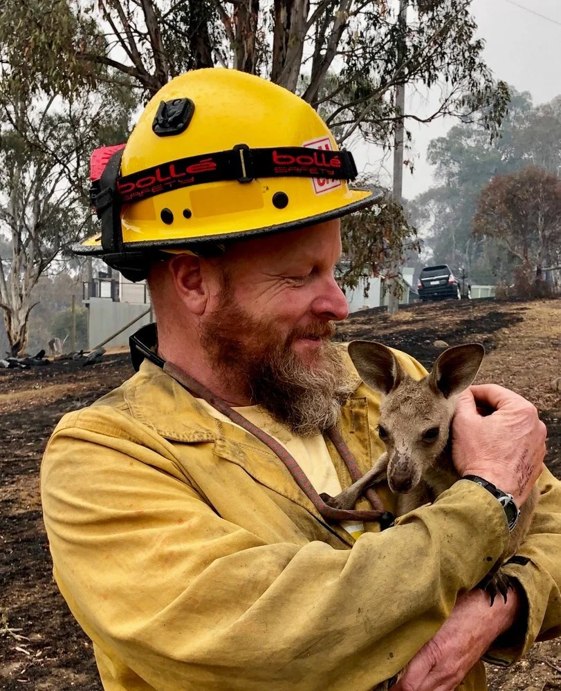
Myth: All wildfire is destructive and should be suppressed immediately.

Fact: Wildfire plays a critical role in many fire-adapted ecosystems and, when appropriate, can be managed for positive effects.

Ponderosa pine are one of the fire-resistant plants in the Western US (Photo credit: Robert Van Pelt/DNR)

Ponderosa pine are one of the fire-resistant plants in the Western US (Photo credit: Robert Van Pelt/DNR)

Ponderosa pine are one of the fire-resistant plants in the Western US (Photo credit: Robert Van Pelt/DNR)

From The Wilderness Society: “Fire has played an important ecological role in forests for thousands of years. Some species of plants depend on periodic wildfires as part of the natural cycle of recovery, and many other species easily tolerate naturally occurring, periodic fires.” Safety of communities and wildland firefighters is paramount when it comes to fire but when conditions are right, wildfires can be managed to “create wildlife habitat, renew soil nutrients and limit the size of subsequent fires by clearing old trees that would otherwise act as fuel”

Myth: There is nothing you can do to prevent wildfire damaging your property.

Fact: There are many things individuals can do to prepare their private property to reduce the risk of wildfire damage.

mitigation-42.jpg

Studies show that as many as 80 percent of the homes lost to wildland fires could have been saved if their owners had followed a few simple firesafe practices. From removing brush and debris to changing the roofing materials on your home there are many opportunities to reduce the risk of damage from wildfire on your property. Click here to visit the Residents Resources page on the Fire Adapted Communities New Mexico webpage and learn more about what you can do on your property!

Myth: Regular logging is enough to prevent forest fires.

Fact: Logging operations can leave forests more vulnerable to intense wildfire, however, strategic thinning can prepare forests for low-intensity, beneficial wildfire.

(Getty Images)

(Getty Images)

From the Wilderness Society: “On a basic level, this argument is sensible; after all, fewer trees means less fire fuel, right? But it's not so simple. Studies have actually found that fires burn more intensely in forests that have been logged. One reason is that the tree remnants left behind in the wake of a logging operation (limbs and tree tops, typically) form a kind of super-charged bed of surface fuel that is dried out thanks to the lack of forest canopy overhead. Another reason is that the new trees that grow in after a forest is logged are all the same age and densely clustered--exactly the kind of trees that burn extra hot and fast, leading to big, intense blazes. Strategically "thinning" forests is a different story. If trees are cut down in carefully planned locations, in forests that are well-adapted to regular ground fire, the practice can help reduce the intensity of wildfires.”


Mitigation Best Practices Training

“This national level training from Coalitions & Collaboratives, Inc. and the USDA Forest Service is designed for current or future mitigation specialists, wildfire program leads, and others who work with residents and their communities to reduce wildfire risk. The Mitigation Best Practices training concentrates on science, methods and tools that will help you engage communities/residents while also helping you to eliminate ineffective practices.

Participants should come with a basic understanding of wildfire, how homes burn, and vegetation management practices. The course assumes you know how to mitigate, but that you could use support engaging your community. In this workshop, you will work through some of the greatest challenges facing our wildland urban interface communities. The course will help you break down ineffective practices to make space for the more effective ones with a focus on the on-the-ground mitigation activities.”

Click here to learn more!

MBP2.jpg

Shortgrass Prescribed Burning Workshop

Are you curious about using prescribed burning in shortgrass rangelands, but not sure if it's safe, effective, and needed? Join us in learning about prescribed burning in the shortgrass prairie. Specialists will host an indoor workshop on November 4, 2021 in the multipurpose room of the Mosquero Municipal School in Mosquero, New Mexico.

Included in the November 4 workshop will be:

· reasons for burning

· special considerations for shortgrass prairie

https___cdn.evbuc.com_images_96560558_423214060085_1_original.jfif

· what to expect after a burn

· how long burn effects will last

· regulations affecting prescribed burning

· weather conditions needed

· formulating a burn plan

· techniques for achieving the burn you want

This workshop and training is being conducted by New Mexico State University Cooperative Extension and Kansas State University in conjunction with the Ute Creek Cattle Company. Additional assistance and cooperation provided by the Great Plains Fire Science Exchange, Southern Rockies Fire Science Network, and the Southwest Fire Science Consortium.

Click here to learn more or register for this workshop!

Action, Implementation, and Monitoring Grant Program

RFP is released August 30th

To sign up for an informational webinar on September 1st, click here.

download (1).jfif

“Action, Implementation and Mitigation (AIM) is a unique funding opportunity. The grant is administered through Coalitions and Collaboratives (COCO), where they understand that funding is only part of the picture. If awarded funding, awardees join a partnership of fellow fire and fuel-reduction practitioners. COCO recognizes that different groups are in different places in terms of partners and mentors and will provide training, mentorship and guidance to awardees throughout the term of their grant agreement. If you anticipate you will need some mentorship or guidance, please build time into your proposal to accommodate that.

Reimbursement funding is available for a wide variety of capacity building  activities, including personnel,  planning efforts and wildfire risk reduction work on nonfederal lands. COCO will be looking to fund a variety of different types of projects across the country. Applicants must demonstrate how their proposal fits into the bigger community wildfire picture, including coordination with federal partners on nearby public lands. Applicants must contribute a 100% match (cash or in-kind match is eligible).  Award funding may range from $10,000 – $75,000. Grants are contracted for a period of one year. Funding will be provided on a reimbursement basis.”

Wildfire Wednesdays #65: Fire in the Arts

Hello Fireshed community!

We hope you’re all having a great week so far. In honor of New Mexico’s vibrant art community we wanted to use this Wildfire Wednesday to talk about the role wildfire plays in the arts. There are many relationships between art and wildfire: Wildfire can serve as a source of inspiration or provide a medium for art, the effects of wildfire can be communicated through art, and art can increase situational awareness or understanding of wildfire. Keep reading to learn more about how artists are being influenced by or incorporating wildfire into their artwork.

This Wildfire Wednesday features information on:

  • Fire journaling (Pyrosketchology)

  • Wildfire as a medium

  • The Fires of Change project

  • Save the Date! March 2022 Cross-Boundary Landscape Restoration Workshop

Stay healthy!

Liz


Fire Journaling

Fire journaling, or pyrosketchology, is a “technique developed by Miriam Morrill to marry the study of fire with journaling and illustration.” This process is being used by artists and community members to document ecological changes on a landscape after fire, increase observational skills and awareness of fire risk, communicate fire science, and more. Click on some of the links below to read more about how artists, scientists, and citizens alike are using fire journaling.

Miriam Morrill

PYROSKETCH FIRE WHEEL.jpeg

Miriam Morrill, a former Bureau of Land Management employee, has been leading workshops to introduce pyrosketchology to fire professionals. Pyrosketchology has the potential to improve situational awareness for firefighters, improve evacuation planning, track ecological changes and risk, and expand peoples’ perceptions of the natural world.

There are two articles of interest focusing on Miriam Morrill’s experiences with pyrosketchology:

Click here to read the Sierra Club’s article

Click here to read the Fire Adapted Communities Learning Network article

Robin Carlson

One of Robin Carlson’s many illustrations from her post-wildfire sketchbook

One of Robin Carlson’s many illustrations from her post-wildfire sketchbook

Robin Carlson is a “local natural science illustrator with a particular interest in following changes in landscapes and ecological communities over time.” Through Steebins Cold Canyon Fire Recovery sketchbook, Robin captures the response and recovery of landscapes post-wildfire.

Click here to learn more about Robin Carlson’s Steebins Cold Canyon Fire Recovery sketchbook


Wildfire as a Medium

While it’s difficult for many to see past the devastation after a wildfire, some artists have managed to find beauty and incorporate the remnants of fire in their artwork.

Laurie Wigham

Laurie Wigham

After the fire

Artist Laurie Wigham used charred sticks from the aftermath of a wildfire in the Sierra Nevada to create watercolor, ink and charcoal paintings of the post-wildfire landscape. Click here to see more of her watercolor paintings of the aftermath of recent forest fires in the Sierra Nevada.

Ashes to Art

Credit: Tim O’Hara

Credit: Tim O’Hara

This project shipped charcoal salvaged from the 2012 High Park Fire and the 2020 Cameron Peak Fire to artists all over the country to be integrated into their art projects in an effort to raise money for the local fire departments. Artists used the charcoal in drawings, pottery, knife handles, etched bowls, and more. Read more about this project on the KUNC website here.


Fires of Change

In 2014, 11 artists participated in a project “designed to integrate fire and climate science with art to offer a unique interpretation for the northern Arizona community... the artists attended field trips to the North Rim of the Grand Canyon and other locations in northern Arizona with fire managers and scientists to learn about fire and climate science” (SWFSC). Following the field trips, art exhibitions featuring the resulting pieces ran in 2015 and 2016. Click here to see a slideshow of the pieces created for this project.

Visitor surveys from the exhibits showed that the Fires of Change exhibit “increased visitors’ understanding of the effect of climate change on fire regimes and increased visitors’ support for management actions to address the effects of climate change on fire behavior.” This demonstrates that art can be a powerful tool for communicating issues around wildfire. Click here to read the paper on this study from the journal of Fire Ecology.


Save the Date! March 2022 Cross-Boundary Landscape Restoration Workshop

CLICK HERE FOR REGISTRATION INFORMATION

Wildfire Wednesdays #64: Fire Around the World

Hello Fireshed members!

We’ve been fortunate here in New Mexico these past few weeks to have gotten some good precipitation from these recent monsoons! Although it sometimes seems that the Western U.S. bears the brunt of the impacts from fire, wildfires are a major issue in many countries across the world. This month alone, 1,500 people have been evacuated from their homes in Sardinia, British Columbia declared a state of emergency as the 300 fires burning in the region destroyed the Canadian village of Lytton and First Nations communities, and the “coldest city in the world” in Siberia has been choked with smoke. While this global problem can feel overwhelming at times, there are efforts being made around the world to prevent and fight wildfires.

This Wildfire Wednesday features information on:

  • How some countries are addressing wildfires around the globe

  • Global fire maps

  • A global perspective on wildfire risk management

Have a great week!

Liz


Fighting wildfires around the globe

Wildfires are a major problem for countries all over the world. In 2020, the Western US, Brazil, Russian Siberia, Indonesia, Australia all experienced some of their most severe wildfire seasons to date. Countries around the world are expanding their wildfire prevention and fighting capacities to address this issue, continue reading to learn more!

Photo Credit: Gershon Elinson/Flash90

Photo Credit: Gershon Elinson/Flash90

Israel

Israel is employing a combination of low-tech fire prevention (“grazing herds of goats, cows and sheep to create protective firebreaks”) and high-tech fire fighting (drones, laser beams, soil moisture and air quality sensors) to minimize the occurrence of and impacts from wildfires. Click here to learn more about the 13 ways Israel is helping the world fight forest fires.

Australia

Photo Credit: Jeremy McMahon

Photo Credit: Jeremy McMahon

Australia’s 2020 devastating wildfire season grabbed global attention as over 46 million acres were burned across the country. One incredible aspect of their firefighting efforts is the 72,000 Australian civilians who made up the world’s largest volunteer fire service. Many of these volunteers put their lives and businesses on hold to continuously fight fires for months at a time with no compensation for their work. Click here to read more about this heroic Australian volunteer firefighting force known as the “firies”

Zambia

To protect the wilderness within Zambia, The Nature Conservancy is offering prescribed burn trainings to local communities and parks. Click here to read more or watch the video below!


Global fire map

Click here to check out this map from NASA to see where fire has occurred across the globe over the past 20 years (most recent data is April 2021).

Example of the global fire map from NASA, July 2018

Example of the global fire map from NASA, July 2018

“The fire maps show the locations of actively burning fires around the world on a monthly basis, based on observations from the Moderate Resolution Imaging Spectroradiometer (MODIS) on NASA's Terra satellite. The colors are based on a count of the number (not size) of fires observed within a 1,000-square-kilometer area. White pixels show the high end of the count — as many as 30 fires in a 1,000-square-kilometer area per day. Orange pixels show as many as 10 fires, while red areas show as few as 1 fire per day.”


Global perspective on managing wildfire risk

“In The Burning Issue: Managing Wildfire Risk, Marsh & McLennan Insights examines the global outlook for wildfire risk in the context of climate change and urban expansions into fire-prone wildlands. The report addresses the total cost of wildfires as well as the drivers of wildfire risk and the outlook in key regions of the world. It concludes with a series of recommendations for how wildfire risk can be managed.”

Click here to read "the burning issue"

Wildfire Wednesdays #63: Fire Technology

Happy Wednesday Fireshed Coalition Members!

While nothing can replace the boots on the ground efforts of firefighters against wildfires, recent technological advances are helping to support and increase safety of these efforts. Today we wanted to share with you some of the new technological advances that are helping fire professionals predict and combat wildfires across the globe.

This Wildfire Wednesday features information on:

  • How drones are being used to fight fires

  • Technology being introduced to increase firefighter safety

  • Silicon Valley’s increased focus on fire technologies

Have a good week,

Liz

Drones & Wildfires

Credit: Steve Peterson

Credit: Steve Peterson

It has been just two years since the Wildfire Management Technology Advancement Act was signed into law, allowing for increased capacity in drones being used on the front lines against wildfires. Drones are being used to drop incendiary devices to create fuel breaks and backburns, map fires with thermal imaging, inspect flight paths for retrofitted jets that release retardant over fires, and provide high-resolution images of fire behavior. Drones can access areas that manned-aircrafts can’t due to size and safety concerns, they can also fly at night and when visibility is low due to smoke which makes them even more valuable in the fight against wildfire. To learn more, read this article from National Geographic: Fireball-dropping drones and the new technology helping fight fires or this article from Discovery: Wildfire Technology - Tackling the Spread of Wilderness Fires with Digital Technology.

Additionally, check out the video below from the Smithsonian Channel that shows how a “predator” drone used infrared technology to locate a missing fire crew and protect critical infrastructure in a 2013 wildfire in Yosemite National Park.

Firefighter tech

Source: Parasim

Source: Parasim

  • Qwake - This helmet-mounted communication device for firefighters “provides aid in navigating fire hazard zones by combining augmented reality (AR), thermal imaging cameras (TICs), cellular and wireless network technologies, camera tracking, GPS localization, and data collection.” (Qwake Technologies Awarded Air Force Contract to Adapt AR Solution for Smokejumpers and Special Operations)

  • PARASIM - This parachute training simulator uses a 3D virtual reality display and suspension harness to mimic the conditions of an actual jump. “Controls, real world scenes, malfunctions, wind profiles, various weather conditions, and a full library of terrain types add up to a realistic experience.” This technology can help smokejumpers prepare for parachuting into wildland fires.

Silicon Valley Fire Technology Investments

California has seen devastating wildfires in recent years. In 2020, 4.2 million acres burned across California, a number that is expected to be exceeded this year. The proximity of Silicon Valley, the global technological hub, to many of the California wildfires has led many developers and investors to turn their attention towards fire prevention and fighting technology. While many of these technologies are solely being utilized in California for now, we would expect at least some of these products and platforms to be available across the US in the upcoming years. Here are some examples of some of the technological advances coming out of Silicon Valley right now (from California wildfires: Fighting bigger blazes with Silicon Valley technology & As wildfires approach Silicon Valley, tech firms struggle to find the backing to fight them)

Source: Zonehaven

Source: Zonehaven

  • Zonehaven: This “Community Evacuation Interface” is a map-based software that connects maps, fire and police departments, dispatchers, and residents to provide reliable information about evacuation updates and preparation resources. This platform is already serving 3.2 million people in over 170 fire districts in California.

  • Rain System: This startup is making a network of drones that can detect and drop retardant on wildfires before firefighter arrive.

  • Buzz Solutions: This software platform uses visual data and algorithms that can detect failures within power grid systems that can lead to wildfires. The software “assesses the likelihood of asset degradation, line health, vegetation encroachment, and future hotspot areas” so repairs can be made prior to wildfires starting.

Wildfire Wednesdays #62: Causes of Wildfires

Hello FACNM community!

We hope you’re all staying healthy during this period of increased smoke across much of New Mexico (check out this map to see fire and smoke distribution across the US). While wildfires are a natural part of our ecosystems, only 10-15% of the global wildfires we experience today are from natural causes. Human-caused fires behave differently than naturally-occurring wildfires and are responsible for 97% of fires that threaten homes in the wildland-urban interface (WUI). Human-caused wildfires have expanded the total area burned across the United States and have more than tripled the length of the wildfire season. In 2020 there were approximately 2,743 human-caused fires that burned 368,729 acres in the Southwest alone.

This Wildfire Wednesday features:

  • Information about the most common human causes of wildfires

  • Measures to reduce risk of wildfire from those human-causes

  • A link to an upcoming webinar of interest

Have a great week!

Liz


Most common human-causes of wildfires

Source: Utah Fire Info

Source: Utah Fire Info

Number of wildfires by type of human ignitions in the Southwest (Source: Increasing Wildfire Awareness and Reducing Human-Caused Ignitions in Northern New Mexico)

Number of wildfires by type of human ignitions in the Southwest (Source: Increasing Wildfire Awareness and Reducing Human-Caused Ignitions in Northern New Mexico)


Human-caused wildfire risk reduction

  • Abandoned campfires: To have a safe campfire (after checking that it’s allowed under current fire restrictions) you should adhere to the following advice from the Cal Fire Campfire Safety page:

    • Cut wood in short lengths, the fire should be no larger than necessary.

    • Never leave a fire unattended.

    • Always keep a shovel and bucket of water nearby.

    • Use the “drown, stir, and feel” method to drown the fire with water, stir the water into remaining embers and ash, mix thoroughly, and feel the area with the back of your hand.

Source: Klamath Falls News

Source: Klamath Falls News

  • Burning debris: Prior to burning any debris you need to check to restrictions in your area and you may need to obtain burn permits. You can burn debris safely by taking these precautions from the Cal Fire Residential Landscape Debris Burning Safety and Southern Foresters Tips for Safe Debris Burning pages:

    • Check to see what weather conditions are expected. Outdoor burning should be postponed if shifts in wind direction, higher winds or wind gusts are forecasted.

    • Clear all flammable material and vegetation down to bare mineral soil within 10 feet of the outer edge of pile or burn barrel.

    • Landscape debris piles should be in small 4 feet by 4 feet piles.

    • Keep a water supply and shovel close to the burning site.

    • A responsible adult must be in attendance until the fire is out.

  • Arson: “Wildfire hotspot modelling, which identifies high potential for arson, can help law enforcement efficiently allocate resources to reduce arson incidents” There are some precautions that individuals and communities can take in order to reduce risk of arson in their area (Increasing Wildfire Awareness and Reducing Human-Caused Ignitions in Northern New Mexico)

    • Reduce hazardous fuels and eliminate attractive hazards such as piled fuels.

    • Monitor weather and climate drivers of wildland arson success and model predictors of arson such as the socio- economic drivers of arson and other crime rates.

    • Establish arson reward programs

  • Powerlines: While most of the fire prevention measures associated with powerlines fall to energy companies, there are some efforts individuals can make to reduce the likelihood of powerlines causing a wildfire:

    • Immediately report any powerlines that are fallen, sparking, or ablaze.

    • If you notice encroaching vegetation near your powerlines, and they are not on your property, immediately call your local electric company to inform them of the potential hazard. DO NOT attempt to trim vegetation around a powerline yourself, this needs to be done by professionals.


Webinar of Interest

Recent fire regimes of the bi-national Madrean Sky Islands- implications for collaborative, transboundary fire management

Miguel_Villarrel.JPG

Presenter: Miguel Villarreal, Western Geographic Science Center, USGS
Date: July 20, 2021 11am AZ/12pm MDT

“In this webinar I will share results of a recent study of contemporary fire regimes over a 32-year period (1985-2017) in the Madrean Sky Islands of the U.S. and México. Our research team evaluated the size, severity and return interval of recent fires in relation to a conceptual model of historical fire regimes for the major biotic communities. During the study period 335 fires burned approximately 28% of the study area, with re-burns occurring on over 25% of the burned areas. The greatest variation in fire regimes, including fire size, frequency, and severity was observed in places with the most diverse human activities and land uses – particularly in the mountain ranges adjacent to the U.S.- México border. Average severity of recent fires was low despite some extreme outliers in cooler, wetter environments. Fire frequency was also higher than historical expectations in these cool and wet environments that support forest types such as Spruce-Fir, indicating threats to these systems possibly attributable to drought and other factors. In cooler and wetter environments in more remote areas of México, pine-oak forests burned with fire frequencies close to historical. In contrast, fires were absent or infrequent across large expanses of lower elevation Woodlands and Grasslands due possibly to overgrazing, which reduces abundance and continuity of fine fuels needed to carry fire. Our findings provide a new depiction of fire regimes in the Sky Islands that can help inform fire management, restoration, and regional conservation planning, fostered by local and traditional knowledge and collaboration among landowners and managers.” 

Click here to register for this webinar NOW!

Click here to view journal article on which this webinar is based.