Wildfire Wednesdays #114: The Importance of Returning Fire to the Landscape

Happy Wednesday, and happy official start of summer, FAC NM community!

Our last Wildfire Wednesday issue, #113, introduced the idea of building landscape resilience (ability to maintain ecological function after a disturbance) through large-scale collaborative land management projects. A common theme was that land managers use forestry treatments such as thinning and prescribed fire to support landscape resilience by creating a diversity of forest structures on the landscape. Local research has shown, time and again, that using targeted forest thinning followed by the intentional return of fire to treat an overly thick and unhealthy forest is the most effective combination for establishing landscape resilience in fire adapted ecosystems. Prescribed burning is a key element in guiding watersheds and forests to be more diverse in species, age, and spacing, and better prepared for wildfire, pests, disease, and other disturbances.

Today’s Wildfire Wednesday features:

  • A review of the use of intentional fire

  • Success stories in your backyard

  • Upcoming events and announcements

Take care,

Rachel


Use of Intentional Fire

A natural history

Many forests across North America but especially in the West “grew up” with fire. Over hundreds of thousands of years, as these landscapes formed, fire was present and endemic plants and animals evolved to be resilient to wildfire (or in some cases, to require it for their reproduction and survival). We refer to these ecotypes as fire adapted forests.

Cartoon drawing of a smiling tree hugging flames licking against its trunk

Communities of the Southwest have, in the past, been fire adapted as well. As we discussed in Wildfire Wednesdays #107, humans and our ancestors have been intentionally using fire for more than 400,000 years. Indigenous communities around the world have used fire in ceremony and management of hunting and plant cultivation, and Euro-American colonizer-settlers used fire to clear land around their communities. This use of fire, mimicking or working in tandem with naturally ignited wildfires, kept forests relatively thin and diverse with a mosaic of open meadows, thick groups of trees in drainages and other topographic features which acted as refugia, and less dense forest along slopes and ridgetops. Fire also maintained a diversity of tree ages and plants which grew under the forest canopy or along streams and rivers.

Smokey Bear poster with a fire blazing in the background, Smokey holding a hurt deer fawn, and the words " our most shameful waste" in bold black letters

After a century of treating forests as a commodity which needed to be protected from “bad” fire, including demonizing and sometimes criminalizing indigenous and other traditional use of fire, folks across the West have begun to reevaluate this relationship. While farmers and ranchers more or less continually used fire to maintain their land, even when fire suppression was the national policy, it wasn’t until the late 1900s to early 2000s that we saw the reintroduction of fire to forested environments through prescribed and cultural burning. Ryan, Knapp, and Varner (2013) write:

“In North America, recognition of the ecological benefits of prescribed burning was slow in coming and varied geographically. Fuel accumulation and loss of upland game habitat occurred especially quickly in productive southern pine forests and woodlands and ecologists in the southeastern US promoted the use of fire in land management from early on. In spite of their convincing arguments, fire in the southeastern US (and elsewhere) was still frequently viewed as incompatible with timber production due to the potential for injury to mature trees and the inevitable loss of tree seedlings.”

Reclaiming our relationship to fire

Scientific, managerial, and, to an extent, public perception has shifted dramatically over the past 20+ years as we have come to understand what many before us inherently knew: that fire is an integral process for maintaining the integrity, stability and beauty of our biotic communities.

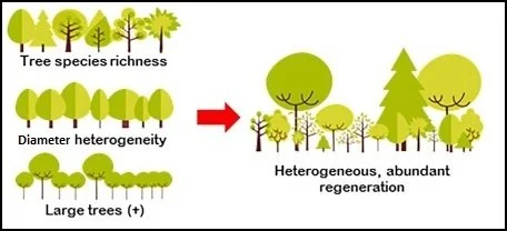
Figure adapted from Tenya et al., 2019

Burning small and burning often in a way which restores forest heterogeneity (diversity of species, age, and type) effectively reduces the density and connectivity of trees within forests and the prevalence of dense forests across landscape. This in turn reduces the severity of subsequent wildfires and makes them easier to manage.

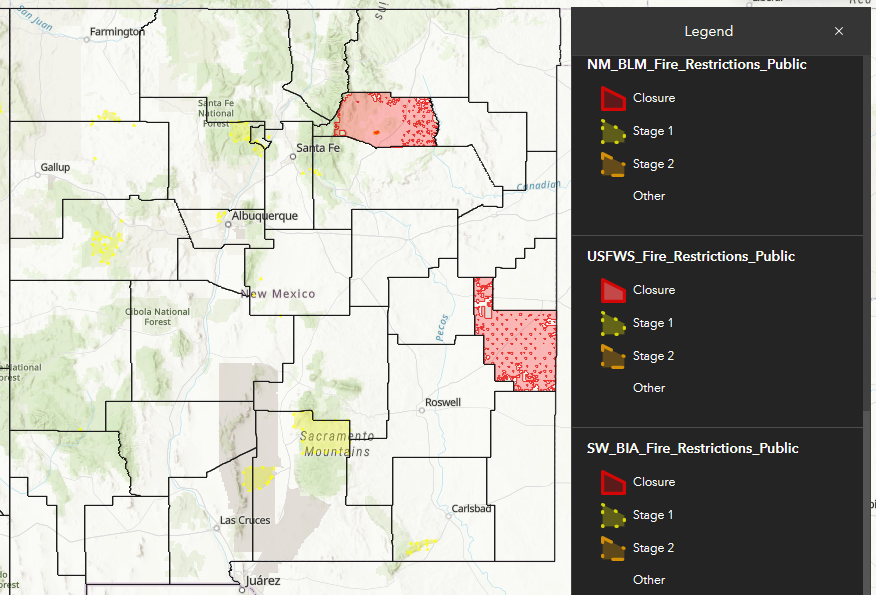
An annual average of 6+ million acres are treated in the U.S. using prescribed fire. According to New Mexico’s 2020 Forest Action Plan, “nearly 5 million acres of forested land need treatment — thinning, prescribed burns or weed management — on a rotating cycle to create resilience to fire. That works out to 300,000 acres a year, a target that the state isn’t even close to reaching” (Searchlight NM, 2022). Despite the challenges and risks, prescribed fire and other means of reintroducing fire to the landscape will need to be part of the solution to this backlog.


Success Stories Close to Home

The Zuni Mountain Collaborative

This story comes to FAC NM from US Forest Service employee Shawn Martin, Silviculturist with the Cibola National Forest.

User map of the Zuni Mountains showing different land ownership areas colored in yellow, orange, grey, white, and green, plus roads in red and recreation sites as small red symbols

Map of the Zuni Mountains Landscape with US Forest Service managed lands highlighted in green.

Where it began
Toward the end of the 1990’s, the Cibola National Forest (CNF) and its partners began to take more interest in managing the Zuni Mountains area as a cohesive landscape. Beginning in 1999, the Forest implemented several projects clocking in at a few hundred acres - the Bluewater Creek Improvement Project, followed by the Bluewater Creek Restoration Project and Bluewater Road Realignment in 2002. Between 2001 and 2003, CNF and Pueblos of Acoma and Zuni applied for and received three Collaborative Forest Restoration Project (CFRP) grants; the Forest Stewards Guild and Mt. Taylor Manufacturing received two more CFRP grants in 2009 and 2010 focused on capacity building, increased forest restoration, and wood utilization.

Cartoon rainbow colored human figures sit around a table holding different colored puzzle pieces

An integral requirement of these federal grants is collaborating with external partners - with members of nearby communities, local nonprofits and businesses, and various landowners or managers in the area - while planning and implementing the funded forest restoration project. Years later, in 2011, when the landscape applied for a long-term Collaborative Forest Landscape Restoration Program (CFLRP) grant for the Zuni Mountains, these same concepts necessitating collaboration and cooperation would apply.

Scaling up
Over the next few years, wildfires across the Southwest and in the landscape, such as the 2004 Sedgwick Fire, began burning hotter, longer, and more acres. These events reinforced the need to increase the pace and scale of forest restoration treatments, invest in ways to utilize wood and establish a forest restoration economy, and create fuelbreaks to protect nearby communities from wildfire. The CNF began surveying larger and larger chunks of land to comply with the National Environmental Protection Act (NEPA) and funding through the American Restoration and Recovery Act created a new instrument to implement forest restoration activities. Following receipt of 10-year CFLRP funding in 2012, low-intensity prescribed fire was reintroduced with the implementation of the Carbon, Fossil, and Copperton burns.

Map of mechanical treatment in zuni mountains with blue and yellow blocks representing different NEPA decisions and blue and green blocks representing completed thinning treatments scattered throughout

Map showing the landscape approach to mechanical thinning in the Zuni Mountains. Thinning began in the southeast portion of the CFLRP boundary (in red), chosen due to ease of access and proximity to the communities of Grants, Thorough, and more.

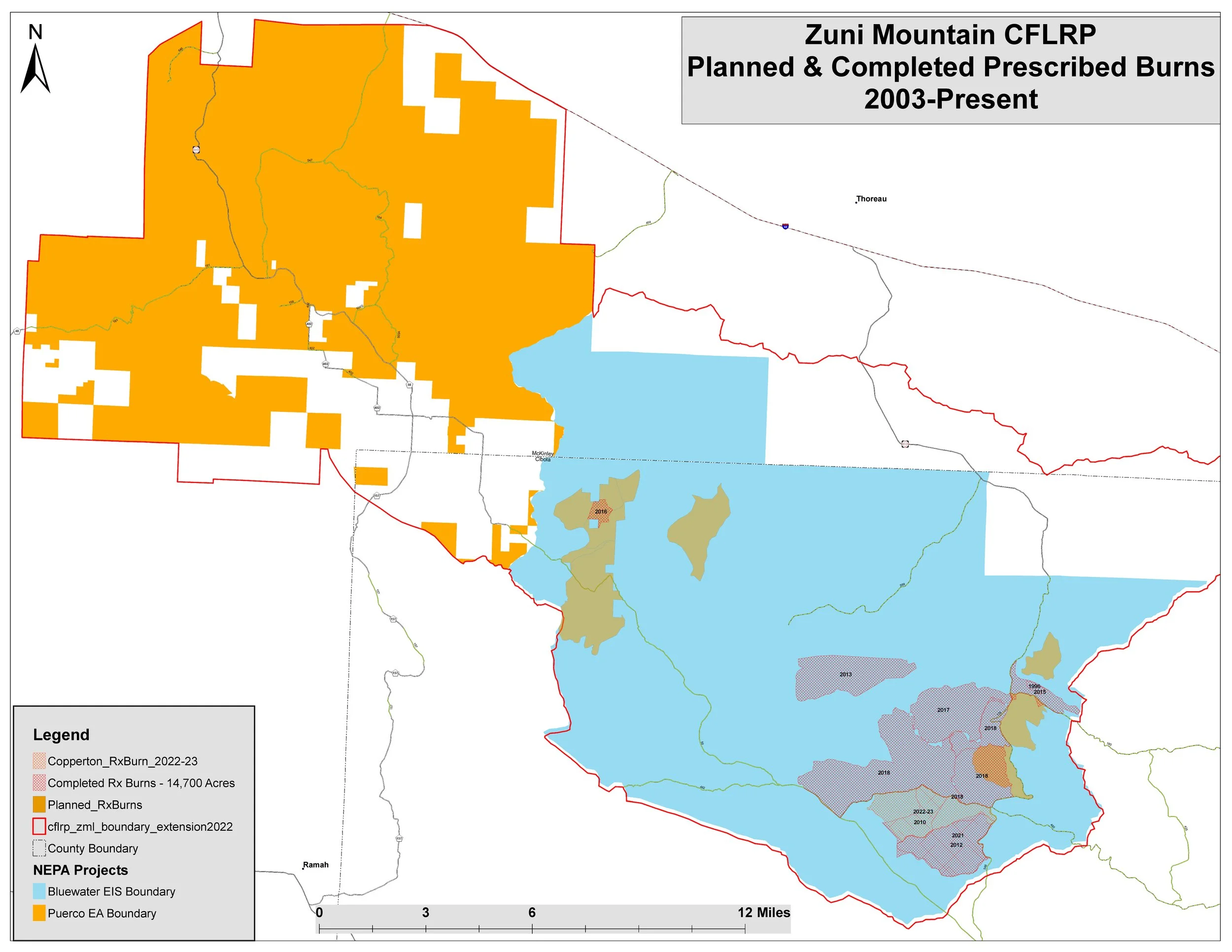
Map showing the landscape approach to prescribed burning in the Zuni Mountains. Prescribed fire generally followed mechanical thinning by a few years, reducing the amount of dead woody material on the ground which is generated by this thinning. In the mid 2010s, firelighters began to increase the size of their burn blocks to treat larger areas.

Prioritizing fire
The 2020 Puerco NEPA decision expanded restoration opportunities beyond just thinning burning to include watershed, wildlife, and range improvements.  Treatments have always been prioritized around building and maintaining a restoration economy, so most thinning has been centered around treating overstocked and even-aged stands that were easily accessible and economically feasible for the MTM mill.  Prescribed fire has generally followed behind forest thinning, but large areas which are either inaccessible for mechanical thinning (wilderness, far from a road, thinning would be too expensive) or are already prepared for the reintroduction of fire (previously thinned or burned, did not experience the same level of historic fire exclusion) have been identified as “burn only”. 

In prioritizing which areas to treat with prescribed fire, managers first considered existing mechanical thinning project plans which they could follow with fire as a secondary treatment. The next logical step in prioritizing prescribed fire treatments was to work out from or expand on that foothold of initial burns. Land managers knew that, in this part of the Southwest, the dominant wind (direction in which the wind blows the majority of the time, having to do with larger atmospheric patterns) came out of the southwest and blew to the northeast. The CNF designed the next decade of treatments, therefore, to a) follow existing road systems for ease of access and b) create a “catcher’s mitt” of restored forest which was treated by thinning and/or prescribed fire and could intercept a wildfire, stopping its forward progress or reducing its severity before it burns into nearby communities to the northeast. Such treatments have proven efficacy, such as the 2013 Rim Fire on the Stanislaus National Forest, just east of California’s Yosemite National Park.

“Even if a previous fire doesn’t stop the subsequent fire, [research] shows that areas recently burned by low to moderate severity fire re-burned at similarly low to moderate severity… In this way, each new reduced severity fire becomes a potential anchor that could be used to limit the spread, moderate severity, and potentially lower the daily smoke emissions of a subsequent fire.”

- Dr. Leland Tarnay, FAC Learning Network, 2018
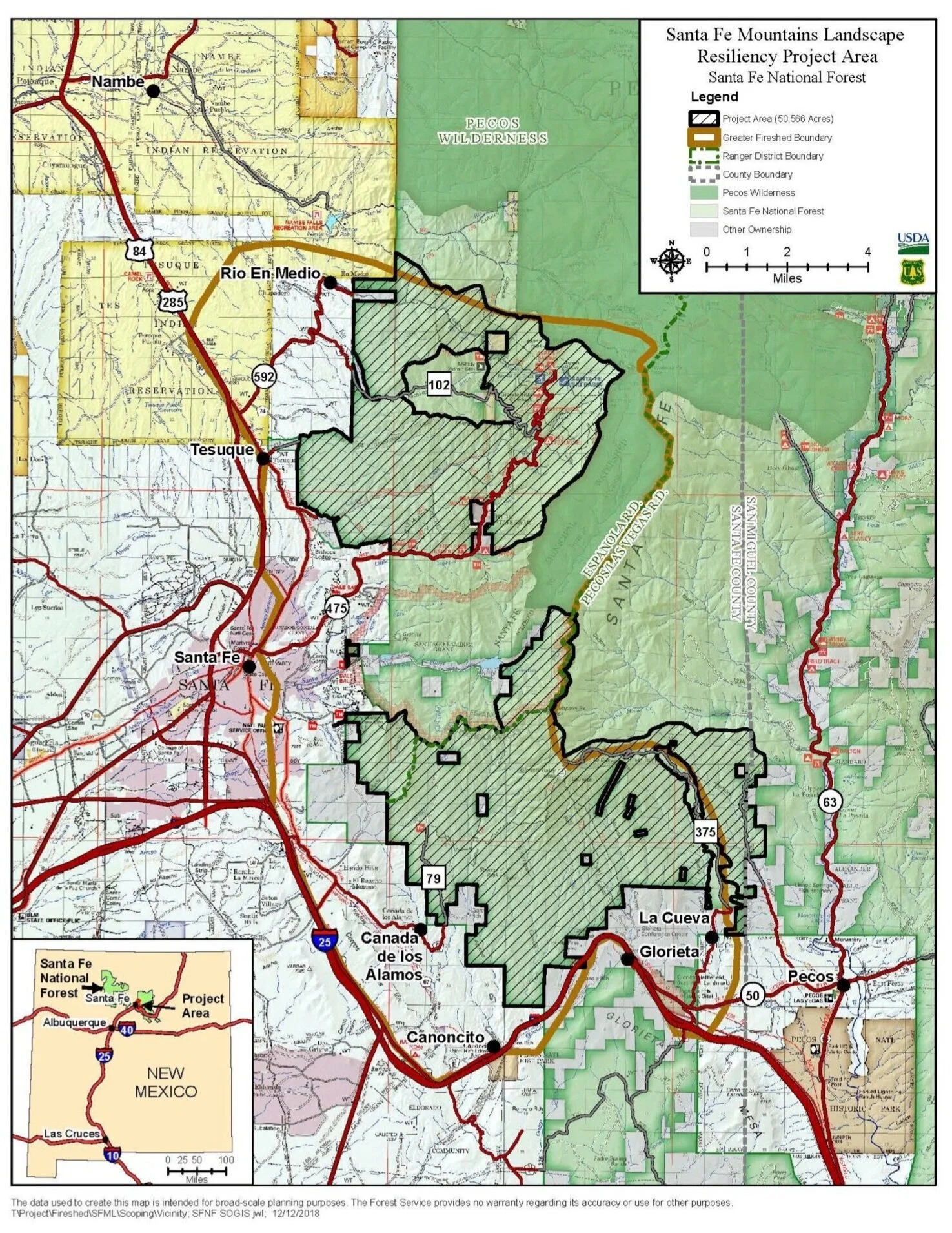
Medio Fire, 2020

In late August 2020, treatments associated with the Pacheco Canyon Forest Resiliency Project played a consequential role in mitigating the forward progress of the Medio Wildfire burning in the Sangre de Cristo Mountains, 11 miles northeast of Santa Fe, NM. These treatments, especially prescribed burns adjacent to a historic fire scar, contained the wildfire and prevented it from burning into and devastating the Santa Fe Municipal Watershed (the source of up to 40% of Santa Fe’s drinking water). Visit the Greater Santa Fe Fireshed Coalition webpage or click on the factsheet or video below to learn more about this success story.

Midnight Fire, 2022

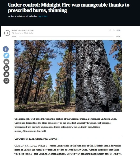
The Midnight Fire burned through a section of the Carson National Forest near El Rito in June, 2022. Fire crews and incident commanders feared that the blaze could grow as big or fast as nearby fires (this was burning at the same time as the Hermit’s Peak - Calf Canyon Complex), but previous prescribed burn projects and managed fires helped stymy its forward progress and reduce the burn severity. The region's previous fire and forest thinning acted as "building blocks" to slow the Midnight Fire. Click the image to the right to read more about this success story in a September article by the Albuquerque Journal.


Upcoming Events and Learning Opportunities

Workshops

July 21 and 27, 2023: Community Wildfire Defense Grant Workshops

NM EMNRD - Forestry Division will hold two workshops to help potential CWDG grant applicants review the lessons learned from the first cycle of this program and learn about changes to current processes. This workshop is intended to help strengthen applications in real time, whether applications submitted in the first round did not get funded or individuals are still thinking about submitting an application. Participants should bring their latest revision of their application for review or their project ideas which have not yet been fleshed out into an application so Forestry Division can provide direction and helpful tips for success. 
If you are unable to attend either of the in-person meetings and would like to have your application reviewed, you can reach out to Abigail Plecki, Community Wildfire Defense Grant Coordinator, and set up a time to meet virtually (505-231-3086 | abigail.plecki@emnrd.nm.gov).   

Webinars

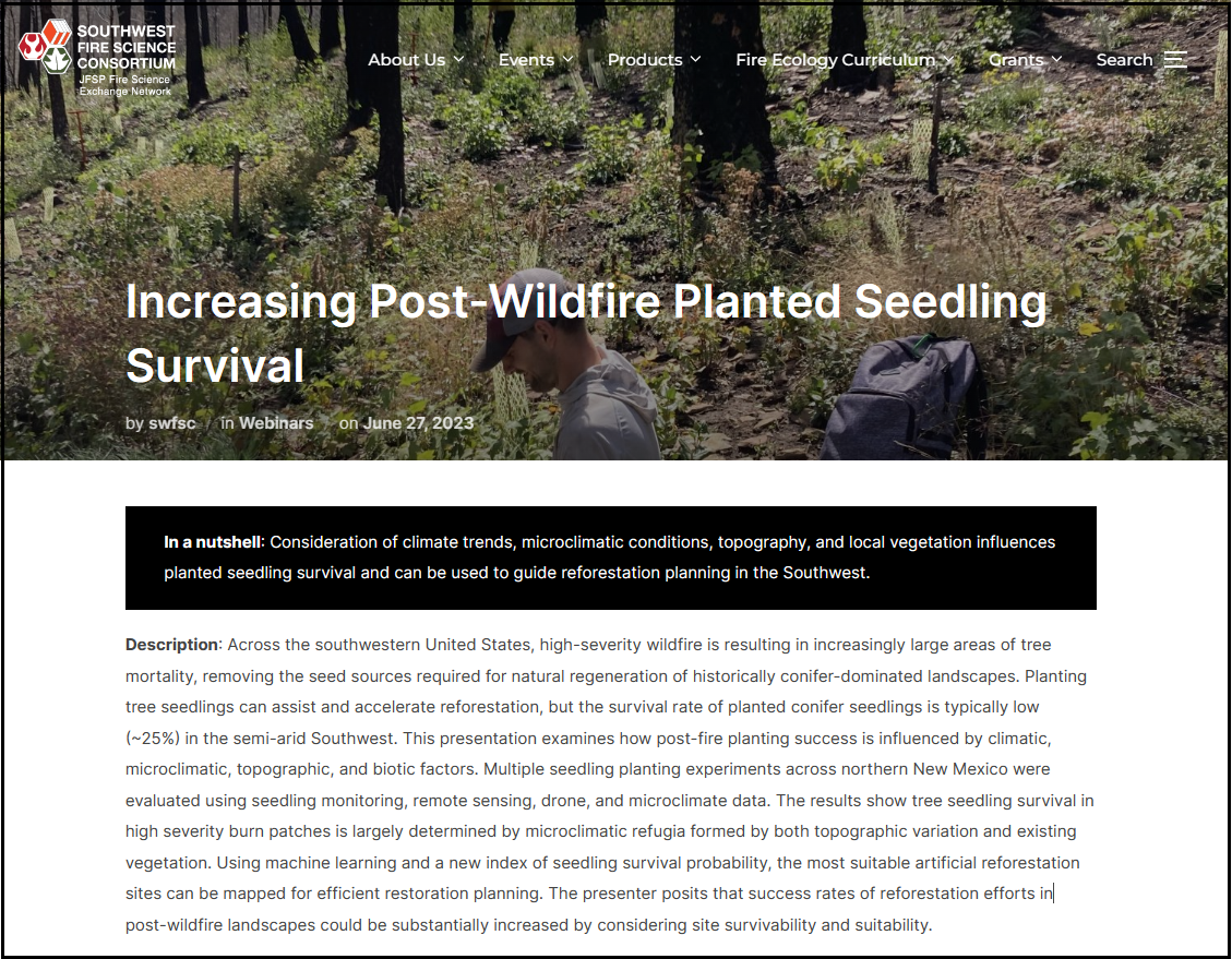
July 25, 2023, 12:00-1:00pm: Increasing Post-Wildfire Planted Seedling Survival
Join the Southwest Fire Science Consortium as Chris Marsh with UNM’s Earth Systems Ecology Lab discusses how consideration of climate trends, microclimatic conditions, topography, and local vegetation influence planted seedling survival and can be used to guide reforestation planning in the Southwest.

REGISTER NOW

Resources in the News

Following the East Coast’s inundation of wildfire smoke from blazes burning in Canada, National Public Radio (NPR) published an article on lessons from the West for dealing with wildfire smoke. While this may be old news to many, the refresher is always worthwhile.
Read it here.

Wildfire Wednesdays #113: Landscape Resilience

Hi Fireshed community,

The mix of fire effects that we see on the landscape contribute to it’s overall resilience - the ability of the forest to “bounce back,” or sustain ecological functions, despite a disturbance. For example, when we see large areas that burn at high severity (high mortality of trees), natural regeneration of the forest becomes challenging, we have to consider more expensive replanting efforts, and we may lose the forested headwaters that provide water to our arid landscape.

To support landscape resilience. land managers use forestry treatments like thinning and prescribed fire to create a diversity of forest structures on the landscape. This diversity of forest structures contributes to a mixed pattern of fire effects when we do see wildfire. Through this variation in forest structures across the landscape, we begin to see a “mosaic” of treated and un-treated areas that can help protect our forests from widespread mortality when we have natural or human-ignited wildfires.

There are many landscape resilience projects happening across the state. This Wildfire Wednesday will feature some (but not all) of the important landscape-scale projects that are helping to protect the future of our forests and watersheds, including:

  • The Santa Fe Mountains Landscape Resiliency Project

  • The Rio Chama Collaborative Forest Landscape Restoration Project (CFLRP)

Best,
Gabe

Landscape Resilience Projects

What are they?

A map from the 2020 NM Forest Action Plan showing 250 of the highest priority watersheds for landscape resilience projects. These watersheds are at the HUC 12 scale (~10,000 - 40,000 acres).

Landscape Scale Restoration projects cross multiple jurisdictions, including Tribal, state and local government, and private forest land, to address large-scale issues such as wildfire risk reduction, watershed protection and restoration, and the spread of invasive species, insect infestation and disease. Projects are developed in partnership with diverse stakeholders and effectively leverage local knowledge, expertise, and resources which results in measurable on-the-ground impacts.

"Landscape scale" does not merely mean acting at a bigger scale: it means conservation is carried out at the correct scale and that it takes into account the human elements of the landscape, both past and present. For many of the projects in New Mexico, our definitions of landscape-scale are closely linked to water - often using watersheds of various sizes or larger river drainage basins.

The Santa Fe Mountains Landscape Resilience Project

Project Status

Signing of the SFMLRP environmental assessment - May 18th, 2023

Surrounded by State, Tribal, and Local partners Thursday, Santa Fe National Forest (SFNF) Supervisor Shaun Sanchez and Acting Deputy Forest Supervisor Jeremy Marshall finalized and signed the Santa Fe Mountains Landscape Resiliency Project (SFMLRP) environmental assessment on Thursday, May 18th, 2023.

Context

The SFMLRP is a 10-year restoration project with actions focused on helping the ponderosa pine and frequent-fire mixed conifer landscapes near New Mexico’s capital city increase resiliency to threats like high-severity wildfire, insects and disease infestation, and climate change. The SFMLRP spans approximately 50,000 acre area, although not all of the area within the project boundary will receive treatment.

Goals

A map of the Santa Fe Mountains Landscape Resiliency Project (SFMLRP)

The purpose of the Santa Fe Mountains Landscape Resiliency Project is to increase the resilience of a priority landscape to future disturbances such as high-severity wildfire, drought, and insect and disease outbreaks. Resilience is the “ability of a social or ecological system to absorb disturbance while retaining the same basic structure and ways of functioning, the capacity for self-organization, and the capacity to adapt to stress and change” (Forest Service Manual 2020.5). This purpose would primarily be accomplished by restoring characteristic structure, function, composition, and spatial pattern to the ponderosa pine and dry mixed conifer forests that comprise much of this landscape. A critical component of improving resilience in the Project Area is creating conditions that facilitate the safe reintroduction of fire, a keystone ecological process, across this landscape.

To increase the resilience of the forests, watersheds, and communities of the Santa Fe Fireshed, The SFMLRP will:

  • Move forests and woodlands (including ponderosa pine, dry mixed conifer, aspen, and piñon-juniper) in the Project Area towards their characteristic species composition, structure and spatial patterns in order to improve ecological function;

  • reduce the risk for high-severity wildfire, create safe, defensible zones for firefighters in areas of continuous fuels and near valued resources that are at risk, and avoid negative post-fire impacts;

  • improve the diversity and quality of habitat for wildlife; and

  • improve soil and watershed conditions.

To stay informed about the status of this project, you can visit the Project website.

The Rio Chama Collaborative Forest Landscape Restoration Project (CFLRP)

Project Status

A map of the Rio Chama CFLRP landscape

Throughout the summer and fall of 2022, forests and meeting spaces throughout northern New Mexico and southern Colorado were filled with discussion surrounding the Rio Chama Collaborative Forest Landscape Restoration Program (CFLRP). Funding for the Rio Chama CFLRP was announced in April of 2022 and the project is underway.

Context

The Collaborative Forest Landscape Restoration Program (CFLRP), enabled by Congress, is designed to increase the resiliency of forests and watersheds in priority forests across the U.S.

The Rio Chama CFLRP provides $30 million in funding over ten years. While the funds from the Forest Service are reserved for federal land, the project is intended to address all lands; private, state, and federal. The federal dollars are leveraged to secure funding for cross-boundary work which is facilitated by a local collaborative group, called the 2-3-2 partnership.

The project covers 3.77 million acres across the region and will provide funding over a 10-year period. The project aims to reduce the risk of uncharacteristic wildfire, restore natural fire patterns, improve watershed resilience and health, and enhance the economic sustainability of industries in the region.

Goals

A bend in the Rio Chama river in the Fall.

The project aims to reduce uncharacteristic wildfire risk by decreasing tree densities and restoring fire regimes to fire-adapted landscapes where low-intensity and mixed-severity fire were prevalent prior fire suppression policy. The suppression and absence of fire in forests of the American Southwest since approximately the 1880s has allowed our forests to become unnaturally dense, which often leads to uncharacteristically intense fire. This wildfire risk has become amplified by climate change. The CFLRP investment is focused on this landscape due to its high priority for water, wildlife, streams and community values.

  • Increase the forest resilience to disturbances like wildfire, insects, disease, and climate change

  • Restore watershed and riparian areas to improve water quality and watershed function

  • Improve range conditions and wildlife habitat and connectivity

  • Support local rural economies and create jobs by utilizing restoration byproducts

  • Connect with tribal, land grant and acequia communities, and engaging youth in public land management

Save-the-date: June 8th Town Hall for Santa Fe Mountains Landscape Resiliency Project

What: Santa Fe Mountains Landscape Resiliency Project Town Hall
Who: Open to the public; hosted by the Santa Fe National Forest and Anna Hansen, Chairwoman of the SFC Board of County Commissioners
When: Thursday, June 8, 2023, 6:30-8:30 p.m.
Where: Santa Fe Community College – Jemez Meeting Rooms
6401 Richards Ave, Santa Fe, NM 87508

Click to view the full announcement of the town hall from Santa Fe National Forest.

Click to view a map of Santa Fe Community College

This Town Hall will provide information on the Santa Fe Mountains Landscape Resiliency Project (SFMLRP) and give the public an opportunity to ask Santa Fe National Forest leadership, program managers, and resource specialists about upcoming project actions.

The SFMLRP is a 10-year restoration project with actions focused on helping the ponderosa pine and frequent-fire mixed conifer landscapes near New Mexico’s capital city increase resiliency to threats like high-severity wildfire, insects and disease infestation, and climate change.

The Town Hall agenda includes a short presentation followed by an opportunity for the public to ask Forest Service staff questions about the project. “We would like to gather input from the community on how to best communicate on project actions over the next 10 years,” stated Forest Supervisor Shaun Sanchez. For more information, please visit the Santa Fe National Forest website or contact USFS Public Affairs staffer Claudia Brookshire at claudia.brookshire@usda.gov.

Wildfire Wednesdays #112: Fire Prevention

Hello and happy Wednesday, Fireshed Coalition readers!

Did you know that of all the wildfires which ignite in the U.S. annually, nearly 90% are human-caused? We’ve heard Smokey Bear telling us to extinguish our campfires (around 44% of all human-caused ignitions start with escaped campfires), but prevention goes far beyond that narrative. Other common culprits include tossed cigarettes, burning yard debris, fireworks, hot exhaust pipes and chains or other items dragging from moving vehicles, agricultural burns, railroads, downed or sparking power lines, and more.

Today’s Wildfire Wednesday features:

  • An Overview of Fire Prevention

  • Fire Restrictions and Forest Closures

  • Upcoming events and announcements

Take care,

Rachel


Fire Prevention

An overview

Fire is a natural part of many ecosystems, but it is also capable of burning at high-intensity and decimating landscapes and communities. For this reason, we look to reduce the amount of fire on the landscape during times of the year when it is more likely to burn hot and out of control.


Interested in learning about fire prevention versus suppression versus exclusion? Read more about the legacy of wildfire in the west and the differences in Wildfire Wednesdays #107.


Fire prevention refers to stopping unwanted wildfires before they start, or ignite - in essence, treating the cause before you get the symptoms. There are two types of wildfire ignitions - natural (lightning and, in some places, volcanoes) and human-caused (both intentional and accidental). With human-caused wildfires accounting for the vast majority of fire starts in the U.S., fire prevention efforts focus on stopping the most common sources to reduce community wildfire risk. The Wildfire Risk to Communities website offers broad categories of prevention tools.

1. Education

“Wildfire prevention education efforts—such as public service announcements, brochures [and signage], social media campaigns, and presentations—can encourage behavior changes and are successful, cost-effective strategies to help decrease the number of human-caused wildfires.” Messaging, training, and school programs provide a good foundation for education. A full list of education program ideas from the National Wildfire Coordinating Group for federal and other fire prevention programs can be found on page 8 of the National Wildfire Prevention Strategy.

2. Regulation

“Regulatory strategies by local governments and land management agencies can be effective [fire prevention tools]. For example, burning regulations and permit systems can be based on current fire danger and historical patterns… Land use planning and zoning can be useful for regulating high-hazard land uses such as sawmills and propane farms.”

3. Enforcement

“Increased patrols by fire service professionals and regular inspections [of equipment or operations that throw sparks such as chainsaws, powerlines, trains, etc.] in fire-prone areas are effective strategies to reduce human-caused wildfires.” Requiring and checking permits and fining and ticketing individuals or businesses who are not following restrictions and regulations are additional enforcement measures. Local forestry and Forest Service personnel can assist with identifying successful techniques.

Needs and Resources

The number one tool on the above list, wildfire prevention education and awareness, is an important component of fire prevention. Although investments in fire prevention have shown to be highly effective at reducing preventable human-caused ignitions, a 2021 report by the Forest Stewards Guild, Investing in Wildfire Prevention, detailed the ways in which many organizations tasked with fire prevention may not be adequately investing time and resources in public education and targeted staff time. Research is ongoing to identify how public education and outreach efforts related to ignition reduction can be improved in human-caused wildfire hotspots in the Southwest; in the meantime, here are a few resources to learn about preventing unwanted wildfires.

  • Prevention How-Tos: Smokey Bear returns to teach us about preventing unwanted wildfires as a result of campfires, backyard debris burning, and equipment use and maintenance.

  • Sparky - fire resources for kids: the National Fire Protection Association has created kid-friendly resources on fire preparedness and prevention to education and empower all members of our community.

  • Wildfire risk visualizer: navigate to your county on the map to see the number of human caused wildfires organized by type (of activity that sparked the fire) and month. Understanding the most prevalent ignition sources helps us to communicate the risk to our communities more effectively.

  • Identify hotspots: a majority of human-caused wildfires start close to population centers (cities, towns, and camps), along travel corridors (roads and trails), and close to recreation sites (campgrounds and trailheads). Resources such as Risk Factor can provide general information about an area’s relative risk of impact by fire, flooding, and more based on topography, vegetation, and possible ignition sources.

  • Wildfire Outreach Materials: from the U.S. Fire Administration and FEMA, these materials provide easy-to-share information on fire prevention and preparation. Review the social media graphics, publications, and more to learn about easy prevention techniques and to share them with your community!

  • One Less Spark: the national campaign offers comprehensive and easy-to-share resources for prevention education including fliers, videos, graphics, and more. The NM Forestry Division produced a 30-second video of the same name covering wildfire prevention basics.

  • BLM Fire Prevention: this video from the Bureau of Land Management summarizes many of the fire prevention resources listed above. While the narrative focuses on the impacts to rangelands, the prevention techniques are applicable regardless of ecosystem type or location.


Restrictions and Closures for Prevention

Know before you go

Preventing human-caused wildfires is a shared responsibility for all New Mexicans and visitors to our state. The following are some simple tips to remember when living, working, or recreating in fire-prone areas across New Mexico.

Restrictions
To reduce the risk of human-caused fires, many state and federal agencies will issue fire restrictions at varying levels during times of high fire danger. Some areas may be closed entirely until the risk of wildfire decreases significantly.

Screengrab of the NIFC Fire Restrictions Map. Click on the image to view the interactive map.

Before planning a trip to a National Forest (the USDA Forest Service Southwest Region office can be reached at 1-877-864-6985), National Park, or other public lands, check with the managing agency, local fire department, or local government for possible fire restrictions. The New Mexico Fire Information website and NIFC Fire Restrictions Map are also excellent resources.

Read more about Red Flag Warnings and other notices of high fire risk conditions in Wildfire Wednesdays #111.

Closures
Wildfire risk can become severe enough during the warm and dry season to warrant excluding people - including recreationists, contractors, researchers, and more - from an area entirely to prevent unwanted fire starts. These exclusions are called closures and they most commonly occur on National Forests and State Parks. They are often put in place because the vegetation is so dry and the temperatures so high that even everyday activities such as driving pose a risk.

New Mexico Wild has a good round-up of resources to find current closures in the areas you are thinking of visiting and NM Fire Info posts area closures as they are announced around the state. Just like researching fire restrictions before you go, the best way to find up-to-date closure information is by calling the managing agency or fire response organization in the area.

Other prevention tips
Visit New Mexico Forest Division’s prevention webpage to learn more about fire prevention tips and tricks.


Upcoming Events and Announcements

Webinars

Friday, June 2, 12:00 - 1:00pm: Fire in the Southwest, Past and Present – Fire Season 2022 Overview and 2023 Outlook
A researcher examines trends in the largest fires in the Southwest of 2022, and a meteorologist explores the fire season outlook and expectations for fire weather behavior in 2023.

REGISTER NOW

Workshops

November 6-10, 2023: 6th National Cohesive Wildland Fire Management Strategy Workshop
Save the date for this national gathering of fire management professionals working in in local, state, Tribal and federal agencies and organizations as well as non-governmental organizations and private companies. Hosted by the National Fire Leadership Council, the workshop will focus on peer-to-peer learning centered around a shared framework for the future.

Resources for Residents

The National Wildfire Coordinating Group just released a report on Standards for Mitigation in the Wildland Urban Interface. This publication, which highlights preparedness aspects of Fire Adapted Communities, provides comprehensive fire mitigation information, recommendations, and standards to be used by professionals, practitioners, and the public across the country.

Wildfire Wednesdays #111: Red Flag

Happy Wednesday, GSFFC community!

Screenshot of a weather application on phone with a blue sky background and a banner reading "red flag warning"

Imagine you’re sitting down to your first cup of coffee in the morning and notice that it looks a little windy outside. You pull out your smartphone and open the weather app to check the forecast. There, at the top of the application, is an alert which reads “Red Flag Warning” from the National Weather Service. What does that mean?

This week’s Wildfire Wednesday will break down severe summer weather alerts, what they mean for fire risk, and how to prepare for Red Flag days.

Today’s Wildfire Wednesday features:

  • What are Red Flag Warnings?

  • The geographic scope and learning more about Red Flag Warnings

  • Recommended actions on Red Flag days

Be well,

Rachel


Red Flag Warnings

What are they?

The origin of the name, Red Flag Warning, is a literal one, according to Tamara Wall of the Desert Research Institute: “If there was… high fire danger, local fire stations would go and run a red flag up the flagpole. It was a very visual, kind of pre-mass communications way to signal to people in the area that it was a high-danger day” (NPR, 4/14/23).

According to the National Weather Service (NWS), which issues these alerts in conjunction with local and state agencies, a Red Flag Warning is part of a weather forecast which indicates a local increase in fire danger risk in the next 12 to 24 hours. This increased risk is due to a combination of critical fuel conditions and critical weather conditions (warm temperatures, very low humidities, and strong winds). This means that if a wildfire starts, the conditions are right for it to spread rapidly and be difficult to contain. Red Flag Warnings differ in timing from a fire weather watch, which warns of the possible development of those conditions in the next 72 hours.

This combination of temperature, humidity, and wind conditions creates what is called critical fire weather. When you see a Red Flag Warning, that also means that critical fire weather is currently or will soon be occurring. The alert, whether online, on the news, or on your weather app, will usually indicate how long the Red Flag Warning is forecast to last. Fire management personnel take Red Flag Warnings into account and may respond by changing staffing numbers or preemptively moving resources into a certain region to be prepared for a potential ignition. During extended periods of high risk, local authorities may consider policy decisions like banning campfires or closing specific areas (see ‘What you should do’, below, for more information).

Indication of fire weather

Fire Facts flier explaining the weather conditions necessary to prompt a red flag warning. Shows FIRE FACTS in bold red letters vertically along the left side of the page and includes a map of the Southwest are dispatch areas

Resource and image adapted from the Northwest Fire Science Consortium.

The four critical weather elements that produce extreme fire behavior are low relative humidity (RH), strong surface wind, unstable air (an incoming or outgoing storm system that creates a significant temperature differential between the land surface and lower atmosphere), and drought (NWCG, Critical Fire Weather). In the Southwest, drought becomes an important precursor to critical fire weather by drying out live vegetation as well as logs, sticks, needles, and grass on the ground, therefore increasing fuel availability. These weather elements, combined to create an unusually dry airmass for the region and season, produce extreme fire behavior when a fire does start.

Drought serves to pre-dry flammable material (fuel) and weakens live vegetation by decreasing the amount of water available, making it more susceptible to pests, disease, and mortality. Warm temperatures and low humidity (moisture in the air) further dry fuels, priming them to burn just like cured firewood. Unstable air creates erratic and often strong winds at ground-level, providing ample oxygen to fire starts and quickly fanning the flames to push the fire through those cured fuels. In this way, fires burn hotter, climb up into the forest canopy, and move faster. As the fire gets bigger, it will begin to pre-heat the vegetation and fuel ahead of the flaming front, enabling it to burn even faster and eventually create its own weather.

With summer and the transition to our monsoonal precipitation pattern rapidly approaching, we should note that light monsoons can produce gusty wind, low RH, and lightning without much precipitation.

Learn more: NWS Explainer

The geographic scope of Red Flag Warnings

How Red Flag Warnings are forecast

There are several contributing factors for when it comes to issuing a Red Flag Warning, but primary guiding criteria include relative humidity of 15% or less combined with sustained surface winds, or frequent gusts, of 25 mph or greater. Both conditions must occur simultaneously for at least 3 hours in a 12 hour period, according to the National Weather Service. 

Meteorologists are moving toward being able to consider how all forecasted weather elements combine to create hazardous conditions, even if they don’t fit the criteria individually. Maybe the RH isn't quite as low as 15%, but the temperature is extremely high and the winds are high, which could lead to dangerous fire weather conditions.

PowerPoint slide showing a map of the US with wind and humidity forecasts combining to identify areas of elevated, critical, or extremely critical fire weather.

Local forecasts inform the national NWS Fire Weather Outlook forecast by feeding into fire weather composite maps and short-wave ensemble forecasts. For local Red Flag Warning alerts, however, meteorologists look at forecasted temperature, incoming and outgoing storm systems (high- and low-pressure systems) with their potential for wind, the likelihood of wet or dry lightning, the dryness of fuels based on recent precipitation and season, and how local terrain will interact with wind and potential ignitions (YouTube: Forecasting Fire Weather in the US).

While Fire Weather Watches may be issued with meteorologists forecasting up to 8 days in advance, Red Flag Warnings are only issued when the severe fire weather conditions meeting the criteria for these Warnings are expected to begin in the next 12-24 hours.

Local alerts

Click to visit the Red Flag map from the National Weather Service

White text on a black screen providing additional information about a Red Flag Warning, including the severity of the threat, the timeframe of the alert, and a description of the threat.

As described in the previous section, fire weather forecasts are specific to a certain geographic area based on storm systems, temperature, terrain, and winds. Accordingly, Red Flag Warnings are site-specific, which means that one part of the state (e.g. the eastern plains near Las Vegas) may be under a Red Flag Warning while another part (e.g. Santa Fe on the other side of the mountains) is not.

The National Weather Service provides information on the scope of Red Flag Warnings. This information may be found in the alert itself (a text box showing what cities or areas are covered by the alert), or can be found by visiting the NWS weather hazards map (far left).


What you should do

How to respond to a Red Flag Warning

Spread the word!

Educate your friends, family, and neighbors on what Red Flag Warnings are, what they mean, and how to respond when they see the warning pop up. Additionally, remind those in your household of the following practical steps to take on Red Flag days.

Research the scope of the Warning and restrictions for your area

Visit the NWS interactive weather hazard map to determine the area covered by a particular Red Flag Warning. Once you know if your current (or planned) location is under a fire weather watch or Red Flag Warning, visit the local city or county webpage to find out if that area is also under current fire restrictions or burn bans.

Map of new mexico overlaid with county boundaries and red shading of various intensities showing local current fire restrictions

Begin your fire restrictions research by clicking on the image to visit the Southwest Area Fire Restriction map, hosted by the National Interagency Fire Center and the SW Coordinating Group.

Local municipalities may issue burn bans for a single day or several days at a time. These usually indicate that residents should refrain from certain activities, such as burning debris piles and cooking over open fires. State and National Parks as well as National Forests, however, may enter into fire restrictions for long periods of time. These restrictions indicate a prolonged (seasonal) period of dangerous fire weather and visitors to these public lands should refrain from building fires outside of designated fire rings or pits, using chainsaws, and more, based on the level of restriction. During the warm months, it is always a good idea to visit the webpage of your destination park or forest prior to leaving so that you are aware of any restrictions in place.

Adjust your behavior accordingly

  • DO NOT burn debris piles.

  • If you are allowed to burn in burn barrels in your area, cover them with a weighted metal cover, with holes no larger than 3/4 of an inch.

  • DO NOT throw cigarettes or matches on the ground or out of a moving vehicle. They may ignite dry grass or debris and start a wildfire.

  • If outdoor fires are allowed, make sure to extinguish them properly. Drown fires with plenty of water and stir with a shovel to make sure everything is cold to the touch with bare skin. Dunk charcoal in water until cold. Do not throw live charcoal on the ground and leave it.

    • Never leave a fire unattended. Sparks or embers can blow into leaves or grass, ignite a fire, and quickly spread.

  • Avoid parking a recently driven vehicle on dry grass or other areas with vegetative cover.

  • Ensure that no chains or hanging metal are dragging from your vehicle or tow-behind trailer which could cause a spark.

Prepare your home

Person checking a window screen from the outside to ensure the window is closed

Before leaving home for the day, make sure that all house and car windows are closed and bring flammable materials like outdoor cushions inside the home or garage.

Photo courtesy of Sonoma County Emergency Management Department.

Create defensible space (including removing dead vegetation from around the house and clearing debris from gutters, around doors, and under porches).

Plan for possible ignitions or evacuations

  • keep your phone charged

  • make sure you know where your loved ones — especially people with disabilities or mobility issues — are during the day

  • make a plan for what to do with any pets or livestock in case of an evacuation.

Additional resources